
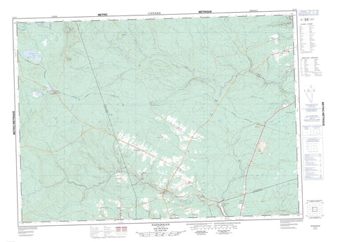
021J07 Napadogan Canada topo map, 1:50,000 scale
021J07 Napadogan NRCAN topographic map.
Includes UTM and GPS geographic coordinates (latitude and longitude). This 50k scale map is suitable for hiking, camping, and exploring, or you could frame it as a wall map.
Printed on-demand using high resolution, on heavy weight and acid free paper, or as an upgrade on a variety of synthetic materials.
Topos available on paper, Waterproof, Poly, or Tyvek. Usually shipping rolled, unless combined with other folded maps in one order.
- Product Number: NRCAN-021J07
- Parent Topo: TOPO-021J
- Map ID also known as: 021J07, 21J7, 21J07
- Unfolded Size: Approximately 26" high by 36" wide
- Weight (paper map): ca. 55 grams
- Map Type: POD NRCAN Topographic Map
- Map Scale: 1:50,000
- Geographical region: New Brunswick, Canada
Neighboring Maps:
All neighboring Canadian topo maps are available for sale online at 1:50,000 scale.
Purchase the smaller scale map covering this area: Topo-021J
Spatial coverage:
Topo map sheet 021J07 Napadogan covers the following places:
- Douglas - Stanley - Birch Island - Louie Island - Palmer Island - Arnold Brook Lake - Fleetwood Lakes - Lower Nashwaak Lake - Marten Lake - Martha Lake - Miramichi Lake - Napadogan Lake - Rocky Brook Lake - Stones Lake - Otter Slide Mountain - Turnbull Mountain - Winding Hill - Hells Gates - Little Louie Rapids - Louies Pup Rapids - Arnold Brook - Bartlett Brook - Bests Brook - Birch Brook - Brewer Brook - Broad Arrow Brook - Cathle Brook - Clearwater Brook - Cross Creek - East Branch Napadogan Brook - East Branch Stewart Brook - English Brook - Falls Brook - Five Mile Brook - Four Mile Brook - Frenchmans Brook - Glen Brook - Grand John Brook - Hinchey Brook - Hovey Brook - Jewett Brook - Lake Brook - Lake Brook - Limekiln Brook - Little South Branch Taxis River - Lower Hayden Brook - MacPherson Brook - Main Southwest Miramichi River - Manzer Brook - McCallum Brook - McGidney Brook - McGivney Brook - McLean Brook - McMillan Brook - McPherson Brook - Meadow Brook - Middle Brook - Middle Hayden Brook - Miramichi River - Napadogan Brook - Nashwaak River - North Branch Cross Creek - North Branch Taxis River - Otter Brook - Palmer Brook - Pidgeon Brook - Radagan Brook - Robinson Brook - Rock Brook - Rocky Brook - Ryan Brook - Sands Brook - Six Mile Brook - South Branch Taxis River - Southwest Miramichi River - Standish Brook - Stewart and Lewis Brook - Stewart Brook - Tamarack Brook - Taxis River - Taxis River - Two Mile Brook - Upper Hayden Brook - Wadham Brook - West Branch Burnt Land Brook - West Branch Clearwater Brook - West Branch Cross Creek - West Branch Stewart Brook - Young Brook - Youngs Brook - McKiel Bogan - McLean Brook Deadwater - Boyds Corner - Centreville - Clearwater - Cross Creek - Cross Creek Station - Currieburg - English Settlement - Fredericksburg - Giants Glen - Glencoe - Gordon Vale - Green Hill - Limekiln - Maple Grove - Maple Grove Station - Mavis Mills - McGivney - Napadogan - Parker Ridge - Red Rock - South Portage - Sutherland - Sutherland Siding - The Glen - Ward Settlement - Williamsburg - Stanley


