
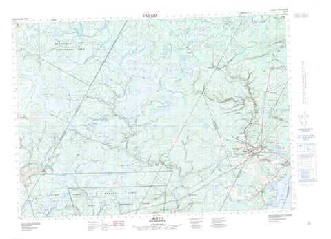
021J01 Minto Canada topo map, 1:50,000 scale
021J01 Minto NRCAN topographic map.
Includes UTM and GPS geographic coordinates (latitude and longitude). This 50k scale map is suitable for hiking, camping, and exploring, or you could frame it as a wall map.
Printed on-demand using high resolution, on heavy weight and acid free paper, or as an upgrade on a variety of synthetic materials.
Topos available on paper, Waterproof, Poly, or Tyvek. Usually shipping rolled, unless combined with other folded maps in one order.
- Product Number: NRCAN-021J01
- Parent Topo: TOPO-021J
- Map ID also known as: 021J01, 21J1, 21J01
- Unfolded Size: Approximately 26" high by 36" wide
- Weight (paper map): ca. 55 grams
- Map Type: POD NRCAN Topographic Map
- Map Scale: 1:50,000
- Geographical region: New Brunswick, Canada
Neighboring Maps:
All neighboring Canadian topo maps are available for sale online at 1:50,000 scale.
Purchase the smaller scale map covering this area: Topo-021J
Spatial coverage:
Topo map sheet 021J01 Minto covers the following places:
- Flowers Cove - Prince Cove - Printz Cove - Wuhrs Beach - McMann Point - Robinson Point - Stony Point - Canning - Chipman - Maugerville - Northfield - Queens - Saint Marys - Sheffield - Sunbury - Waterborough - Bear Island - Butternut Island - Goat Island - Long Island - Alexs Pond - Arrowhead Pond - Boomerang Pond - Breeze Pond - Burpee Lake - Cattail Pond - Clare Lake - Crystal Pond - Dorsey Lake - Dougtom Pond - Elm Tree Pond - Grand Lake - Graves Pond - Horsetail Pond - Layden Pond - Lucky Pond - Milky Pond - Mills Pond - Mustang Pond - Outlet Pond - Pitcher Pond - Pond in the River - Princess Pond - Puddle Pond - Reef Pond - Ryder Lake - Shale Pond - Speculator Pond - Spruce Lake - Spruce Pond - Squaretail Pond - Sturtevant Pond - Sundew Pond - Tapley Lake - Tapley Pond - Timber Lake - Timber Pond - Turtle Pond - Upper Crystal Pond - Wangytang Pond - Wrestler Ponds - Mount Hope - Sewell Ridge - Refuge d'oiseaux de l'Île du Corossol - Albright Brook - Bailey Brook - Bailey Brook - Barton Brook - Baxter Brook - Bear Brook - Beaver Brook - Bull Pasture Brook - Burntbrow Brook - Burpee Mill Stream - Burpee Millstream - Butler Brook - Cains River - Clare Brook - Conroy Brook - Doherty Creek - Dorsey Brook - East Branch Penniac Stream - East Brook - East Brook - East Penniac Stream - Eighteen Brook - Estey Brook - Flower Brook - Flowers Brook - Fork Brook - Fulton Brook - Gilchrist Brook - Gormley Brook - Gosnell Brook - Grand Lake Little River - Highbank Brook - Hiltz Brook - Holland Brook - Horseback Brook - Howard Brook - Hume Brook - Hungry Brook - Hurley Brook - Hurley Creek - Hurley Creek - Jeffrey Brook - Little Burpee Brook - Little River - Little Stoney Brook - Lyon Brook - Lyons Brook - McKenzie Brook - Moonshine Brook - Moosehole Brook - Mount Pleasant Brook - Mowatt Brook - Newcastle Creek - Niles Brook - Noonan Stream - North Branch East Brook - North Branch Penniac Stream - North Forks Stream - North Penniac Stream - Penniac Stream - Penniac Stream - Perley Brook - Peter Brook - Pond Stream Brook - Red Brook - Red Brook - Red Pine Brook - Reece Brook - Ryder Brook - South Branch East Brook - Stoney Brook - Sullivan Brook - Sunbury Creek - Sutherland Brook - Upper Bailey Brook - Vance Brook - Veness Brook - Wasson Brook - West Branch Baltimore Stream - Wildcat Brook - Yeamans Brook - Big Forks - Burpee Deadwater - Clare Brook Deadwater - Little Forks - Albright Corner - Albrights Corner - Avon - Butler - Cantor - Doherty - Duffys Corner - Flowers Cove - Hardwood Ridge - Humphrey Corner - Linton - Lower Durham - Mount Hope - New Avon - New England Settlement - New Zion - Newcastle Bridge - Newcastle Creek - North Minto - Northfield - Rothwell - Scale - Slope Road - South Minto - Sunbury - Upper Penniac - Bull Pasture Plains - Cranberry Bog - Dorsey Heath - Lauder Heath - The Cranberry Bog - Minto


