
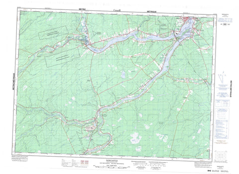
021I13 Newcastle Canada topo map, 1:50,000 scale
021I13 Newcastle NRCAN topographic map.
Includes UTM and GPS geographic coordinates (latitude and longitude). This 50k scale map is suitable for hiking, camping, and exploring, or you could frame it as a wall map.
Printed on-demand using high resolution, on heavy weight and acid free paper, or as an upgrade on a variety of synthetic materials.
Topos available on paper, Waterproof, Poly, or Tyvek. Usually shipping rolled, unless combined with other folded maps in one order.
- Product Number: NRCAN-021I13
- Parent Topo: TOPO-021I
- Map ID also known as: 021I13, 21I13
- Unfolded Size: Approximately 26" high by 36" wide
- Weight (paper map): ca. 55 grams
- Map Type: POD NRCAN Topographic Map
- Map Scale: 1:50,000
- Geographical region: New Brunswick, Canada
Neighboring Maps:
All neighboring Canadian topo maps are available for sale online at 1:50,000 scale.
Purchase the smaller scale map covering this area: Topo-021I
Spatial coverage:
Topo map sheet 021I13 Newcastle covers the following places:
- Blacks Cove - Flett Cove - Jones Cove - McKay Cove - Mullins Cove - Oxford Cove - Shillelagh Cove - Beaubears Point - Beaubears Point - Boom Point - Gaspereau Point - Goodfellows Point - Schultz Point - Shultz Point - Strawberry Point - Wilsons Point - Hawgee Creek - Indiantown Creek - Miramichi - Blackville - Blissfield - Chatham - Derby - Glenelg - Nelson - Newcastle - Northesk - Northumberland - Rogersville - Southesk - Eel Ground 2 - Indian Point 1 - Red Bank 4 - Red Bank 7 - Renous 12 - Barnaby Island - Beaubears Island - Exmoor Island - Gibbons Island - Indian Island - Johnsons Island - Little Indian Island - McHughs Island - Mitchells Islands - Patsys Island - Tozers Island - Crocker Lake - Smiths Lake - Augustine Mound - Beaubears Island Shipbuilding National Historic Site of Canada - Boishébert National Historic Site of Canada - Camp de l'Espérance - Lieu historique national du Canada Boishébert - Lieu historique national du Canada de la Construction-Navale-à-l'Île-Beaubears - Lieu Oxbow - Oxbow Site - The Enclosure - The Enclosure Provincial Park - Tumulus Augustine - Black Rapids - Appleby Brook - Barnaby River - Buttys Brook - Carding Mill Brook - Castor Brook - Crown Point Brook - Curtis Brook - Cushman Brook - Doyles Brook - Dungarvon River - Elmtree Brook - Gillice Brook - Gooseberry Meadow Brook - Gray Rapids Brook - Hackett Brook - Harris Brook - Hellcat Brook - Indiantown Brook - Indiantown Brook - Jam Brook - Jardine Brook - Jardine Brook - Johnstone Brook - Lake Brook - Lake Brook - Little Castor Brook - Little Millstream - Little Semiwagan Brook - Little Sevogle River - Little Southwest Miramichi River - Main Southwest Miramichi River - McDonald Brook - McKay Brook - McKendrick Brook - McKenzie Brook - McNeal Brook - McNeal Brook - Meadow Brook - Meadow Brook - Middle Barnaby River - Middle Branch Barnaby River - Mill Brook - Mill Stream - Miramichi River - North Branch Indiantown Brook - North Branch McNeal Brook - North Indiantown Brook - Northwest Millstream - Northwest Miramichi River - Oxford Brook - Pine Island Brook - Renous River - Reserve Brook - Reserve Brook - Right Hand Branch Barnaby River - Saunders Brook - Semiwagan River - Semiwagan Stream - South Branch McNeal Brook - Southwest Miramichi River - Spring Brook - Stewart Brook - Sutherland Brook - Walsh Brook - West Branch Indiantown Brook - West Indiantown Brook - White Rapids Brook - Wild Cat Brook - Wildcat Brook - Wilson Brook - Blackmore Bogan - Castor Bogan - Johnsons Bogan - Johnstones Bogan - Semiwagan Deadwater - The Oxbow - Amos - Barnaby River - Barnett - Barnettville - Boom Road - Bryenton - Cassilis - Chatham Head - Chelmsford - Coughlan - Craigville - Derby - Derby Junction - Douglasfield - Doyles Brook - Eel Ground - Elmtree - Exmoor - Flat Landing - Garden Road - Grainfield - Gray Rapids - Halcomb - Harris Brook Settlement - Hughes - Indian Gardens - Ivory Road - Jones Crossing - Kirkwood - Lockstead - Lower Barnaby - Lower Barnaby River - Lower Derby - Lyttleton - Manderville - Matthews - Matthews Settlement - McCann - McKinleyville - Millerton - Nelson - Nelson Junction - Nelson-Miramichi - Newcastle - North Esk Boom - North Renous - North West Bridge - Northwest Bridge - Nowlanville - Park - Parker - Passmore - Pineville - Quarryville - Red Bank - Renous - Reynolds - Semiwagan Ridge - Sillikers - Smiths Crossing - South Esk - South Nelson Road - South Renous - Strathadam - Sunny Corner - Underhill - Upper Barnaby - Upper Derby - Upper Nelson - Warwick Settlement - West Collette - White Rapids - Whitney - Williamstown - Big Plain - Indian Marsh - Semiwagan Meadows - Strawberry Marsh - Barnaby - South Nelson


