
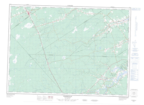
021I11 Rogersville Canada topo map, 1:50,000 scale
021I11 Rogersville NRCAN topographic map.
Includes UTM and GPS geographic coordinates (latitude and longitude). This 50k scale map is suitable for hiking, camping, and exploring, or you could frame it as a wall map.
Printed on-demand using high resolution, on heavy weight and acid free paper, or as an upgrade on a variety of synthetic materials.
Topos available on paper, Waterproof, Poly, or Tyvek. Usually shipping rolled, unless combined with other folded maps in one order.
- Product Number: NRCAN-021I11
- Parent Topo: TOPO-021I
- Map ID also known as: 021I11, 21I11
- Unfolded Size: Approximately 26" high by 36" wide
- Weight (paper map): ca. 55 grams
- Map Type: POD NRCAN Topographic Map
- Map Scale: 1:50,000
- Geographical region: New Brunswick, Canada
Neighboring Maps:
All neighboring Canadian topo maps are available for sale online at 1:50,000 scale.
Purchase the smaller scale map covering this area: Topo-021I
Spatial coverage:
Topo map sheet 021I11 Rogersville covers the following places:
- Bass River Point - Acadieville - Carleton - Huskisson - Kent - Northumberland - Richibucto - Rogersville - Saint-Charles - Saint-Louis - Weldford - Jerrys Island - Middle Island - Kent Lake - Lac à Jos-Wilfrid - Lac Saint-Joseph - Lake Francis - Meadow Lake - Sabbies Lake - Duffs Hill - Monument Notre Dame de L'Assomption - Baldwins Brook - Barnaby River - Bass River - Beaver Brook - Beaver Pond Brook - Bells Creek - Big Brook - Big Brook - Big Cove Creek - Big North Fork - Birch Creek - Burnt Camp Brook - Cails Brook - Chapel Brook - Chappel Brook - Clares Creek - Coal Branch River - Cold Spring Brook - Craigy Brook - Currie Brook - Dales Brook - Dargavels Brook - Davies Brook - Duffs Brook - East Barnaby River - East Branch Barnaby River - East Branch Little Forks Stream - East Branch Russel Brook - East Branch Sabbies River - East Sabbies River - Ferris Brook - Flaggy Brook - Fraser Brook - George Beers Creek - Hector Fork - Hudson Brook - Jim Young Brook - Jimmy Graham Fork - Johnny Graham Fork - Kates Brook - Kellock Brook - Kingston Brook - Kouchibouguac River - Kouchibouguacis River - Kouchibouguacis River - Little Beaver Brook - Little North Fork - Lower Meadow Brook - McCafferty Brook - McDonald Brook - McInnes Brook - McInnes Brook - McKays Creek - Meadow Brook - Molus River - Napier Brook - North Molus River - Quarry Brook - Richibucto River - Rivière Française - Rivière Saint-Charles - Rivière Saint-Louis - Roach Brook - Ruisseau à Antoine-Allain - Ruisseau à Baptiste - Ruisseau à Pierre à Jean - Ruisseau de la Truite - Ruisseau de la Truite-Sud - Ruisseau des Babineau - Russel Brook - Sabbies Brook - Smith Brook - South Branch Kouchibouguac River - South Branch McInnes Brook - South Brook - South Kouchibouguac River - South Trout Creek - Southwest Aldouane River - Stewart Brook - Taylor Brook - Trout Brook - Trout Creek - Upper Meadow Brook - Waterloo Brook - Waterloo Creek - West Branch Russel Brook - Whalen Brook - North Forks - North Forks - North Forks Molus River - South Forks - Acadie - Acadieville - Aldouane - Aldouane Station - Bass River - Bass River East - Bass River Point - Belliveau - Bretagneville - Browns Yard - Camerons Mill - Camerons Mills - Centre Acadie - Centre-Acadie - Desherbiers - Kent Junction - Kent Lake - Kent Lake Siding - Kent Lake Station - Molus River - Noinville - Pineau - Pleasant Ridge - Pont du Millieu - Pont-du-Milieu - Saint-Athanase - Saint-Charles - Saint-Charles-Nord - Saint-Ignace - Saint-Ignace Siding - Saint-Joseph - Saint-Luc - Sapin-Court - Shediac Ridge - Smiths Corner - St. Augustine - St. Charles - St. Charles Nord - St. Ignace - St. Ignace Station - St. Joseph - St. Luc - St-Athanase - St-Augustine - St-Charles-Nord - Ste-Augustine - St-Ignace - St-Luc - Targettville - Upper Main River - Val St. Patrice - Val-St-Patrice - Vautour - Village St. Pierre - Village-Saint-Pierre - Village-St-Pierre - Young Ridge - Rogersville


