
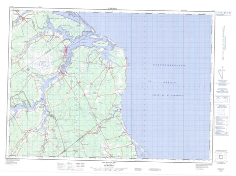
021I10 Richibucto Canada topo map, 1:50,000 scale
021I10 Richibucto NRCAN topographic map.
Includes UTM and GPS geographic coordinates (latitude and longitude). This 50k scale map is suitable for hiking, camping, and exploring, or you could frame it as a wall map.
Printed on-demand using high resolution, on heavy weight and acid free paper, or as an upgrade on a variety of synthetic materials.
Topos available on paper, Waterproof, Poly, or Tyvek. Usually shipping rolled, unless combined with other folded maps in one order.
- Product Number: NRCAN-021I10
- Parent Topo: TOPO-021I
- Map ID also known as: 021I10, 21I10
- Unfolded Size: Approximately 26" high by 36" wide
- Weight (paper map): ca. 55 grams
- Map Type: POD NRCAN Topographic Map
- Map Scale: 1:50,000
- Geographical region: New Brunswick, Canada
Neighboring Maps:
All neighboring Canadian topo maps are available for sale online at 1:50,000 scale.
Purchase the smaller scale map covering this area: Topo-021I
Spatial coverage:
Topo map sheet 021I10 Richibucto covers the following places:
- Anse à Fidèle - Baie de Buctouche - Baie de Saint-Louis - Baie du Village - Birchbark Creek - Blanchard Creek - Buctouche Harbour - Church Cove - Daigles Creek - Fond de la Baie - Grande Anse - Gulf of St. Lawrence - McAlmon Creek - Mooneys Creek - North Cove - Northwest Arm - Northwest Branch - Richibucto Harbour - Ruisseau à Clorice-Legere - Ruisseau à Jos-Allain - Ruisseau des Richard - Buctouche Bar - Buctouche Sand Bar - Dune de Chockpish - North Beach - North Richibucto Beach - North Richibucto Dune - South Beach - South Richibucto Beach - Chapel Point - Church Point - Fagan Point - Gros Cap - Jardine Point - McGuires Point - Pagan Point - Point Bess - Pointe à la Gadèle - Pointe de Forgeron - Pointe de l'Eglise - Pointe de l'Église - Pointe de Violon - Pointe des Allain - Pointe des Georges - Pointe des Mares - Pointe des Richard - Pointe Le Vielle - Pointe Sec - Pratts Point - Richibucto Cape - Richibucto Head - Richibucto Point - Sock Point - York Point - Détroit de Northumberland - Little Gully - Northumberland Strait - Passe de l'Ile - Richibucto Gully - Kent - Richibucto - Saint Mary - Saint-Charles - Saint-Louis - Weldford - Wellington - Indian Island 28 - Richibucto 15 - Almond Island - French (Richibucto) Island - Indian Island - McAlmon Island - Aldouane Lake - Geddes Lake - Jardine Lake - Kouchibouguacis Lagoon - Lac à Camille - Le Barachois - Loggie Pond - Dune de Buctouche - Galloway Hill - McIntosh Hill - Bonar Law House - Église Sainte-Anne-de-Kent - Kouchibouguac National Park of Canada - Maison de Bonar Law - Parc national du Canada Kouchibouguac - Aldouane River - Beatties Creek - Big Brook - Big Cove Creek - Black Brook - Black River - Childs Creek - Chockpish River - East Branch - East Branch St. Nicholas River - East St. Nicholas River - Gaspereau Creek - Gaspereau Creek - Gaspereau River - Kouchibouguacis River - Mazerall Creek - McKays Creek - Mill Creek - Petite rivière Aldouane - Petite Rivière Aldouane - Richibucto River - Rivière à Étienne - Rivière aux Masquis - Rivière Chockpish - Rivière Chockpish-nord - Rivière des Vaches - Rivière du Cap - Rivière Française - Rivière Saint-Charles - Rivière Saint-Louis - Ruisseau à Baptiste - Ruisseau à Petit-Pierre - South Branch - South Branch St. Nicholas River - South St. Nicholas River - Spring Brook - St. Nicholas River - St. Nicholas River - Thomas Brook - Watering Creek - Weldon Creek - West Branch - West Branch St. Nicholas River - West St. Nicholas River - McGuires Middle Ground - Richibucto Bar - Richibucto - Babineau - Bedec - Bells Mills - Big Cove - Caissie-Village - Cap Lumière - Cap-Lumière - Chockpish - Collette Village - Collette-Village - Côte Ste. Anne - Côte-Sainte-Anne - Côte-Ste-Anne - East Branch - East Galloway - Galloway - Galloway - Grande Aldouane - Grande-Aldouane - Jardineville - Little Aldouane - Lower Main River - Lower Saint-Charles - Lower St. Charles - Lower St-Charles - Main River - Marquant - Mundleville - Peters Mills - Petit-Chockpish - Petite Chockpish - Petite-Aldouane - Petite-Chockpish - Pirogue - Richibucto Village - Richibucto-Village - Saint-Charles - Saint-Charles Station - Sainte-Anne-de-Kent - Saint-Edouard-de-Kent - Saint-Édouard-de-Kent - Saint-Gabriel-de-Kent - Saint-Pierre-de-Kent - South Branch - South Branch St. Nicholas River - Spring Brook - St. Charles - St. Edouard de Kent - St. Gabriel de Kent - St. Louis de Kent - St. Pierre - Ste. Anne de Kent - Ste-Anne-de-Kent - St-Edouard-de-Kent - St-Gabriel-de-Kent - St-Louis-de-Kent - St-Pierre - Upper Rexton - Village La Prairie - Village Ste. Croix - Village-des-Arsenault - Village-La-Prairie - Village-Sainte-Croix - Village-Ste-Croix - West Branch - West Branch St. Nicholas River - West Galloway - Caribou Plain - Mocauque du Cap - Plaine de Saint-Charles - Rexton - Saint-Louis de Kent - Saint-Louis-de-Kent


