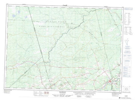
021I03 Salisbury Canada topo map, 1:50,000 scale
021I03 Salisbury NRCAN topographic map.
Includes UTM and GPS geographic coordinates (latitude and longitude). This 50k scale map is suitable for hiking, camping, and exploring, or you could frame it as a wall map.
Printed on-demand using high resolution, on heavy weight and acid free paper, or as an upgrade on a variety of synthetic materials.
Topos available on paper, Waterproof, Poly, or Tyvek. Usually shipping rolled, unless combined with other folded maps in one order.
- Product Number: NRCAN-021I03
- Parent Topo: TOPO-021I
- Map ID also known as: 021I03, 21I3, 21I03
- Unfolded Size: Approximately 26" high by 36" wide
- Weight (paper map): ca. 55 grams
- Map Type: POD NRCAN Topographic Map
- Map Scale: 1:50,000
- Geographical region: New Brunswick, Canada
Neighboring Maps:
All neighboring Canadian topo maps are available for sale online at 1:50,000 scale.
Purchase the smaller scale map covering this area: Topo-021I
Spatial coverage:
Topo map sheet 021I03 Salisbury covers the following places:
- Albert - Brunswick - Coverdale - Havelock - Kings - Moncton - Queens - Salisbury - Westmorland - Goose Lake - Lake Stream Lake - Lower Lake - Snowshoe Lake - Keenan Hill - Leeman Hill - Steeves Mountain - Abe Corey Brook - Alward Brook - Bannister Brook - Ben Keith Brook - Blakeney Brook - Blakney Brook - Boundary Creek - Brandy Brook - Buctouche River - Canaan River - Cocagne River - Coldstream Brook - Coverdale River - Coy Brook - Dead Brook - Deep Hollow Brook - Duncan Brook - Dunstan Brook - East Branch Canaan River - East Canaan River - Five Mile Brook - Five Mile Brook - Fivemile Brook - Forks Stream - Four Mile Brook - Four Mile Brook - French Brook - Hasty Brook - Intervale Creek - Jordan Meadow Brook - Keohan Brook - Killam Brook - Killam Meadow Brook - Lake Stream - Lewis Mountain Brook - Lipsett Brook - Little River - Lower North Branch Canaan River - Lower North Canaan River - McDonalds Brook - McLeod Brook - McNaughton Brook - Middle North Branch Canaan River - Middle North Canaan River - Montgomery Brook - Murphy Meadow Brook - Nevers Brook - North Branch Cocagne River - North Cocagne River - North River - Paddy Brook - Petitcodiac River - Pollet River - Pollett River - Poplar Brook - Popple Brook - Price Brook - Ridge Brook - South Branch Buctouche River - South Branch Canaan River - South Buctouche River - South Canaan River - Springhill Brook - Springhill Brook - Thorne Brook - Thorne Brook - Thornes Brook - Thornes Brook - Three Mile Brook - Three Mile Brook - Trites Brook - Upper North Branch Canaan River - Upper North Canaan River - Walker Brook - West Alward Brook - West Branch Alward Brook - Will Taylor Brook - Wilmot Brook - Wilmot Brook - Wilson Brook - Alward - Boundary Creek - Butternut Ridge - Canaan - Canaan - Canaan Road - Canaan Station - Cherryvale - Dobsons Corner - East Canaan - Five Points - Fredericton Road - Gallagher - Gallagher Ridge - Harewood - Havelock - Hicksville - Killams Mills - Lewis Mountain - Monteagle - New Canaan - North Branch - Salem - Scott Road - Second North River - Segawa - Springhill - Steeves Mountain - Steeves Settlement - Thrope - Upper Ridge - Wheaton Mills - Wheaton Settlement - Jordan Meadow - Killam Meadow - Murphy Meadow - Salisbury

