
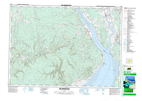
021H15 Hillsborough Canada topo map, 1:50,000 scale
021H15 Hillsborough NRCAN topographic map.
Includes UTM and GPS geographic coordinates (latitude and longitude). This 50k scale map is suitable for hiking, camping, and exploring, or you could frame it as a wall map.
Printed on-demand using high resolution, on heavy weight and acid free paper, or as an upgrade on a variety of synthetic materials.
Topos available on paper, Waterproof, Poly, or Tyvek. Usually shipping rolled, unless combined with other folded maps in one order.
- Product Number: NRCAN-021H15
- Parent Topo: TOPO-021H
- Map ID also known as: 021H15, 21H15
- Unfolded Size: Approximately 26" high by 36" wide
- Weight (paper map): ca. 55 grams
- Map Type: POD NRCAN Topographic Map
- Map Scale: 1:50,000
- Geographical region: New Brunswick, Canada
Neighboring Maps:
All neighboring Canadian topo maps are available for sale online at 1:50,000 scale.
Purchase the smaller scale map covering this area: Topo-021H
Spatial coverage:
Topo map sheet 021H15 Hillsborough covers the following places:
- Cranberry Cove - Grande Anse - Hendersons Cove - Shepody Bay - Calhoun Flats - Maringouin Flats - Big Cape - Cape Demoiselle - Cole Head - Cole Point - Dorchester Cape - Dorchester Island - Fort Folly Point - Hopewell Cape - Memramcook Spit - Albert - Coverdale - Dorchester - Elgin - Harvey - Hillsborough - Hopewell - Sackville - Westmorland - Fort Folly 1 - Gray Island - Grays Island - Indian Island - Indian Island - Blackwood Lake - McFadden Lake - Memramcook Lake - Palmers Pond - Pink Rock Lake - Stanyard Lake - Boars Back - Caledonia Mountain - Crooked Creek Lookout - Fillmore Hill - Flint Hill - Foley Hill - Hayward Pinnacle - Jonah Hill - Kent Hills - Lewis Mountain - Lime Rocks Hill - Livingstones Hill - Oak Hill - Oil Hill - Pound Hill - Round Hill - Shepody Mountain - Solomon Hill - Stuart Mountain - Sweet Mountain - William Prosser Mountain - Bell Inn - Chapelle de Beaumont - Keillor House - Le Bell Inn - Lieu historique national du Canada du Monument-Lefebvre - Maison de Keillor - Monument Lefebvre National Historic Site of Canada - The Rocks Provincial Park - Apple Creek - Arabian Vault Brook - Ayers Brook - Back Brook - Beaman Brook - Bear Brook - Beaver Brook - Beaver Brook - Beeman Brook - Belliveau Creek - Bennett Brook - Berry Brook - Berryton Brook - Big Spring Brook - Blackwood Brook - Bordeaux Creek - Boudreau Creek - Boyd Creek - Bray Brook - Breau Creek - Brydon Brook - Bull Creek - Bull Creek - Caledonia Brook - Canada Creek - Canadian Brook - Cariboo Brook - Caribou Brook - Carson Brook - Cat Creek - Chapman Creek - Chemical Creek - Coverdale River - Crank Brook - Crooked Creek - Curryville Creek - Daniel Brook - Daniels Brook - Deed Brook - Demoiselle Creek - Downey Brook - Downing Creek - Dryden Brook - East Branch Little River - East Branch Turtle Creek - East Turtle Creek - Elliott Brook - Flat Brook - Fox Brook - Frederick Brook - Georges Brook - George's Brook - Godfrey Brook - Hamilton Creek - Hayward Brook - Hiram Brook - Hopper Brook - Hopper Creek - Keillor Brook - Keillor Brook - Keillor Brook - Le Blanc Creek - Leaman Brook - LeBlanc Creek - Little River - Lower Maple Creek - Lumsden Brook - Lumsden Brook - McFadden Brook - McGee Brook - McHenry Brook - McKinley Brook - McKinley Brook - Meadow Brook - Memel Creek - Memramcook River - Mill Brook - Mill Creek - Mill Creek - Minors Brook - Mitton Brook - Mollins Brook - Northwest Branch Brook - Northwest Branch Crooked Creek - Northwest Crooked Creek - Palmers Creek - Patterson Brook - Peck Creek - Petitcodiac River - Pow Brook - Prescott Brook - Prosser Brook - Randall Brook - Rat Tail Brook - Rhody Brook - Robbs Brook - Rockwell Creek - Sawmill Creek - Shaw Brook - Shaw Creek - Sherman Brook - Spar Brook - Stiles Brook - Stoney Creek - Stony Creek - Stuart Brook - Tingley Brook - Toms Brook - Tower Brook - Turner Creek - Turtle Creek - Upham Brook - Upper Creek - Upper Maple Creek - Weldon Creek - Wells Brook - West Branch Turtle Creek - West Turtle Creek - Wilson Brook - Cape Rocks - Grande Anse Ledge - Middle Ground - Middle Ground - The Rocks - Albert Mines - Baltimore - Baltimore - Beaumont - Beech Hill - Belliveau Village - Berryton - Boudreau Village - Breau Creek - Caledonia Mountain - Caledonia Settlement - Cap Demoiselle Creek - Cape - Cape Station - Chemical Road - Chester - College Bridge - Colpitts - Colpitts Settlement - Cormier Cove - Cormier's Cove - Curryville - Dawson - Dawson Settlement - Demoiselle Creek - Dorchester Cape - Dover - Edgett Landing - Edgetts Landing - Edgett's Landing - Ferndale - Flint Hill Settlement - Gautreau Village - Hopewell Cape - Hopewell Hill - Hopper - Isaiah Corner - Johnson Mills - Johnson's Mills - La Montagne - Le Lac - Little Dover - Little River - Lower Cape - Lumsden Settlement - McGinleys Corner - McGinley's Corner - Memel Settlement - Memramcook East - Middleton - Montaigne - Mountville - Nixon - Osborne Corner - Parkindale - Pré d'en haut - Pré-d'en-Haut - Prosser Brook - Rockland - Rosevale - Saint-Joseph - Salem - Shenstone - Shepody - St. Joseph - Steeves Mills - Steevescote - Stoney Creek - Stony Creek - Stony Creek Station - Surrey - Taylor Village - Turtle Creek - Upper Dorchester - Upper Turtle Creek - Weldon - Woodworth - Woodworth Settlement - Oliver Gulch - Breau Marsh - Burley Bog - Daniels Flats - Shepody Marsh - Dorchester - Hillsborough - Memramcook - Riverside-Albert


