
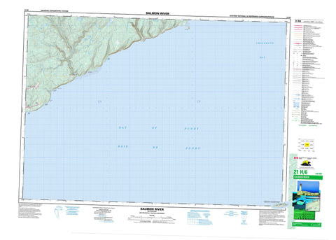
021H06 Salmon River Canada topo map, 1:50,000 scale
021H06 Salmon River NRCAN topographic map.
Includes UTM and GPS geographic coordinates (latitude and longitude). This 50k scale map is suitable for hiking, camping, and exploring, or you could frame it as a wall map.
Printed on-demand using high resolution, on heavy weight and acid free paper, or as an upgrade on a variety of synthetic materials.
Topos available on paper, Waterproof, Poly, or Tyvek. Usually shipping rolled, unless combined with other folded maps in one order.
- Product Number: NRCAN-021H06
- Parent Topo: TOPO-021H
- Map ID also known as: 021H06, 21H6, 21H06
- Unfolded Size: Approximately 26" high by 36" wide
- Weight (paper map): ca. 55 grams
- Map Type: POD NRCAN Topographic Map
- Map Scale: 1:50,000
- Geographical region: New Brunswick, Canada
Neighboring Maps:
All neighboring Canadian topo maps are available for sale online at 1:50,000 scale.
Purchase the smaller scale map covering this area: Topo-021H
Spatial coverage:
Topo map sheet 021H06 Salmon River covers the following places:
- Baie de Fundy - Baie de Fundy - Bay of Fundy - Bay of Fundy - Chignecto Bay - Berry Beach - Fownes Beach - Long Beach - Melvin Beach - Seely Beach - Black Point - Boars Head - Fownes Head - Martin Head - Tufts Point - Saint John - Saint Martins - Ile Haute - Isle Haute - Arnold Lake - Donnelly Lake - Dowdall Lake - Four Mile Lake - Little Donnelly Lake - Mary Pitcher Lake - McFadden Lake - Pats Lake - Portage Lake - Rody Lake - Rody Lake - Tufts Lake - Walker Lake - Cumberland - Nouvelle-Écosse - Nova Scotia - Berry Brook - Big Rody Brook - Big Salmon River - Cradle Brook - Cranberry Brook - Dowdall Lake Brook - Dustan Brook - Falls Brook - Falls Brook - Flaglar Brook - Four Mile Brook - Fownes Mill Brook - Fuller Brook - Hemlock Brook - Hunter Brook - Little Rody Brook - Little Salmon River - Long Beach Brook - Macomber Brook - Martin Head Stream - Mary Pitcher Brook - McCumber Brook - Northwest Branch Big Salmon River - Northwest Salmon River - Porter Brook - Quiddy River - Rapidy Brook - Renard Brook - Rody Brook - Row Brook - Saddleback Brook - Seely Beach Brook - Telegraph Brook - Walker Lake Brook - Walton Glen Brook - Wolf Brook - Bay View - Fair View - Greer - Greer Settlement - Little Beach - Salmon River - Diamond Gulch


