Mount Everest : 50th anniversary expedition map
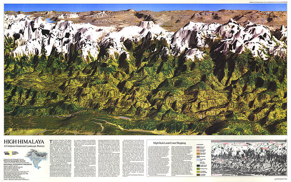
As seen in the May 2003 issue of National Geographic, this double-sided map celebrates the 50th anniversary of Sir Edmund Hillarys ascent to the summit of Mt. Everest. Side one features a digital rendering of Mount Everest created from infrared images taken by the space shuttle combined with stereo photographs taken from a jet aircraft. The work of generations of surveyors—stretching back to the days of George Everest himself—undergirds like bedrock this most detailed digital model of Mount Everest. The reverse side shows a map of Sagarmatha National Park and surrounding areas. Inset maps and informative sidebars describe the Sherpas, special locations in the area, the growth in visitors to the region, and the routes taken by famous Everest expeditions.
The map is packaged in a 2-diameter clear plastic tube. The tube has a decorative label showing a thumbnail of the map with dimensions and other pertinent information.
- Product Number: NG_EVER_WA_3
- Reference Product Number: 2173881M
- ISBN: 9780792249931
- Date of Publication: 6/1/2003
- Unfolded (flat) Size: 46.85 inches high by 29.92 inches wide
- Map format: Wall
- Map type: Trade Maps - Specialty
- Geographical region: Nepal