
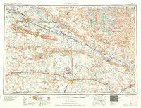
~ Scottsbluff NE topo map, 1:250000 scale, 1 X 2 Degree, Historical, 1954, updated 1958
Scottsbluff, Nebraska, USGS topographic map dated 1954.
Includes geographic coordinates (latitude and longitude). This topographic map is suitable for hiking, camping, and exploring, or framing it as a wall map.
Printed on-demand using high resolution imagery, on heavy weight and acid free paper, or alternatively on a variety of synthetic materials.
Topos available on paper, Waterproof, Poly, or Tyvek. Usually shipping rolled, unless combined with other folded maps in one order.
- Product Number: USGS-5564112
- Free digital map download (high-resolution, GeoPDF): Scottsbluff, Nebraska (file size: 20 MB)
- Map Size: please refer to the dimensions of the GeoPDF map above
- Weight (paper map): ca. 55 grams
- Map Type: POD USGS Topographic Map
- Map Series: HTMC
- Map Verison: Historical
- Cell ID: 69020
- Scan ID: 317951
- Imprint Year: 1958
- Woodland Tint: Yes
- Visual Version Number: 1
- Field Check Year: 1954
- Datum: Unstated
- Map Projection: Transverse Mercator
- Map published by United States Army Corps of Engineers
- Map published by United States Army
- Map Language: English
- Scanner Resolution: 600 dpi
- Map Cell Name: Scottsbluff
- Grid size: 1 X 2 Degree
- Date on map: 1954
- Map Scale: 1:250000
- Geographical region: Nebraska, United States
Neighboring Maps:
All neighboring USGS topo maps are available for sale online at a variety of scales.
Spatial coverage:
Topo map Scottsbluff, Nebraska, covers the geographical area associated the following places:
- Sunflower Mobile Home Park - Doyle - Rackett - Coldwater Trailer Court - Bayard - South Bayard - Huntsman - Evergreen Estates Mobile Homes - Conestoga Mobile Home Park - Bradley - Covert - James - Sidney - Oshkosh - Northside Mobile Home Ranch - Harrisburg - Lynn - Mount Vernon - Redus - Bridgeport - Gordons Mobile Plaza - Gering - Alden - Jacinto - Trout - Lakeview Mobile Park - Potter - Point of Rocks - Joyce - Barton - Bonner - Dalton - Redington - McGrew - Hubbard Corner - Hartman - Moomaw Corner - Caldwell (historical) - Kemp - Broadwater - Carlson - Colton - Mintle - Dix - Mitchell - Big Springs - Nebraska Boys Ranch - Perrin - Stahr Trailer Court - South Mitchell - Atkins - Morrill - Brownson - Harrys Mobile Home Incorporated - Angora - Haig - Scottsbluff - Vance - Gurley - Stegall - Lewellen - Mumper - Sunrise Village Mobile Home Park - Mobile Manor Trailer Park - Jane - South Morrill - Bushnell - Lisco - Owasco - Northport - Piper - Mohler - Melbeta - Terrytown - Ridgewood Mobile Home Park - Craft - Kimball - Hillerage - Lodgepole - Baxter - Costin - Tony - DeGraw - Stahlas North Court - Heldt - Ruthton - Chappell - Oliver - Sunol - Pelton - Minatare - Lorenzo - Morrill Mobile Home Estates
- Map Area ID: AREA4241-104-102
- Northwest corner Lat/Long code: USGSNW42-104
- Northeast corner Lat/Long code: USGSNE42-102
- Southwest corner Lat/Long code: USGSSW41-104
- Southeast corner Lat/Long code: USGSSE41-102
- Northern map edge Latitude: 42
- Southern map edge Latitude: 41
- Western map edge Longitude: -104
- Eastern map edge Longitude: -102


