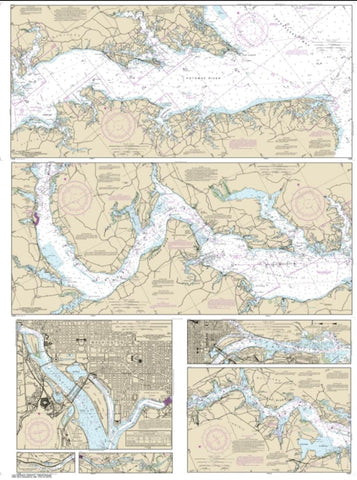
Potomac River; District of Columbia (12285-41) by NOAA
East View Map Link (EVML), a certified NOAA and NGA print on demand printer; provides mariners with up-to-date National Oceanic and Atmospheric Administration (NOAA) approved nautical charts.
Our Potomac River recreational chart booklet (Map Index 12285) is lithographically printed on acid free paper.
The latest Notice to Mariners (NTMs) update will be included with each order.
All recreational chart booklets meet United States Coast Guard and international carriage requirements for commercial and recreational vessels. All NOAA recreational chart booklets are printed exclusively for East View Map Link, LLC.
- Product Number: 1010474M
- Product Code: NOAA_12285
- Year of Publication: 2016
- Unfolded Size: 15.77 x 36.410 inches
- Map type: Flat Map
- Geographical region: Maryland