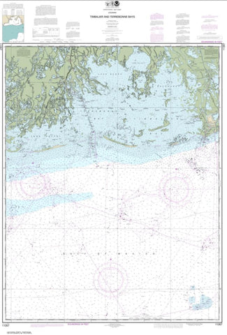
Timbalier and Terrebonne Bays (11357-43) by NOAA
East View Map Link (EVML), a certified NGA and NOAA print on demand printer provides mariners with historical National Geospatial-Intelligence Agency POD approved nautical charts, using high resolution, heavyweight and acid free paper. All NGA nautical charts ship rolled, and are printed by East View Map Link, LLC.
Magnetic variation provided; Bathymetry by contours at intervals as small as 2 meters with spot depth in meters; shallow coastal water in blue; lighthouses, buoys, wrecks, submerged and awash rocks, obstructions, submarine cables, pipelines, islands, and islets shown; Larger-scale maps in the series show shore characteristics (sandy, rocky, cliffs), bridges, and harbor features (piers, wharfs, jetties, breakwaters).
- Product Number: 1009455M
- Product Code: NOAA_11357
- Year of Publication: 2014
- Unfolded Size: 50.33 x 34.130 inches
- Map type: Flat Map
- Geographical region: United States