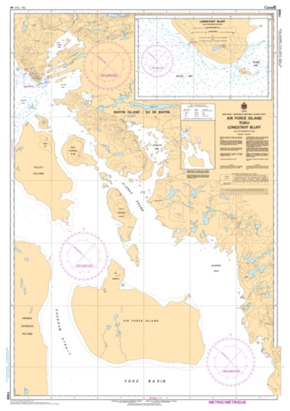
Approaches to/Approches a Moose River by Canadian Hydrographic Service
This Canadian Nautical Chart by the Canadian Hydrographic Service (CHS) is printed by East View Map Link (EVML), a certified CHS print on demand printer; provides mariners with up-to-date Canadian Hydrographic Service (CHS) approved nautical charts. Printed using high resolution, heavy weight and acid free paper, or alternatively on waterproof synthetic materials. All charts are printed with the latest Notice to Mariners (NTMs), and meet Canadian Coast Guard and international carriage requirements for commercial and recreational vessels. All CHS nautical charts ship rolled.
- Product Number: 2194211M
- Product Code: CHS_5860
- Year of Publication: 2005
- Map type: Flat Map
- Geographical region: Canada