
1902 Philippines Military Telegraph Lines North Map
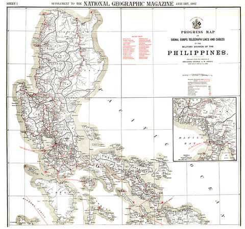
This map was produced in astonishing detail as a supplement to the January, 1902 National Geographic Magazine, and accompanies the southern Philippines map. Just four years earlier, the United States purchased the rights to the territory from Spain for $20,000,000, and this beautiful map shows the entire group of islands, anlong with a detailed inset of the Manila Bay area. Anyone interested in history or the Far East will find this map to be an excellent addition to your map collection.
- Product Number: PODHNG_PHIL_MIL_N_02
- Reference Product Number: 2321352M
- ISBN: - None -
- Date of Publication: 6/1/1902
- Unfolded (flat) Size: 33.75 inches high by 36 inches wide
- Map format: Wall
- Map type: Trade Maps - Historical
- Geographical region: Philippines


