
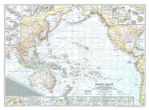
1943 Pacific Ocean, and the Bay of Bengal Map
Published in September 1943 during World War II, this map of the Pacific Ocean and the Bay of Bengal contains an abundance of detail. With inset maps of over fifty islands, boundaries and notes showing the political administration of islands, typical storm tracks, time zones, and both airline and nautical distances, this work makes a fine addition to any map collection.
- Product Number: PODHNG_PAC_O_43
- Reference Product Number: 2321599M
- ISBN: - None -
- Date of Publication: 6/1/1943
- Unfolded (flat) Size: 27.5 inches high by 37.25 inches wide
- Map format: Wall
- Map type: Trade Maps - Wall Art


