
1962 New Zealand, New Guinea and the Principal Pacific Islands Map
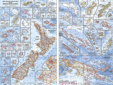
This map of the Pacific Ocean includes Australia, the Pacific Islands, and the continental coastlines that border the ocean. Inset maps provide detail of some of the larger islands groups. Published in April 1962, this map accompanied an article on New Zealand and the map of New Zealand, New Guinea and the Principal Pacific Islands.
- Product Number: PODHNG_NZ_PNG_62
- Reference Product Number: 2321603M
- ISBN: - None -
- Date of Publication: 6/1/1962
- Unfolded (flat) Size: 19 inches high by 25 inches wide
- Map format: Wall
- Map type: Trade Maps - Political


