
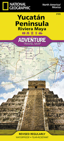
Yucatan, Mexico Adventure Map 3105 by National Geographic Maps
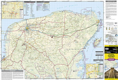
National Geographics Northern Yucatan / Maya Sites, Mexico AdventureMap is designed to meet the unique needs of adventure travelers with its durability and accurate information. This folded map provides global travelers with the perfect combination of detail and perspective, highlighting hundreds of points of interest and the diverse and unique destinations within the country. The map includes the locations of cities and towns with a user-friendly index, plus a clearly marked road network complete with distances and designations for major highways, main roads, and tracks and trails for those seeking to explore more remote regions. The Northern Yucatan AdventureMap covers most of the Yucatan peninsula including the popular Caribbean destinations of Isla Mujeres, Cancun, Playa del Carmen, Akumal, Cozumel, Puerto Aventuras, and Tulum.
Every AdventureMap is printed on durable synthetic paper, making them waterproof, tear-resistant and tough - capable of withstanding the rigors of international travel.
Key Features:
- Waterproof and tear-resistant
- Accurate topography/terrain with a clearly labeled road network
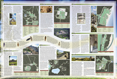
- Hundreds of points of interest, including the locations parks and nature reserves, protected lands, historical and cultural attractions
- Thousands of place names including towns and natural features; detailed place names index
- Important travel networks including airports, lighthouses, ferry routes and rail lines
- Updated regularly to ensure accuracy.
- Product Number: 2034481M
- Product Code: NG_AM_YUCATAN
- Publisher Product ID: AD00003105
- ISBN: 9781566952453
- Year of Publication: 2009
- Folded Size: 9.45 x 4.33 inches
- Unfolded Size: 24.8 x 33.07 inches
- Map type: Folded Map
- Geographical region: Mexico


