
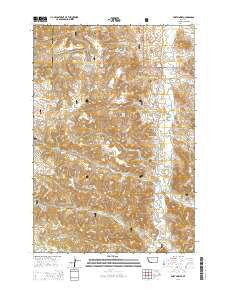
~ Fort Howes MT topo map, 1:24000 scale, 7.5 X 7.5 Minute, Current, 2014
Fort Howes, Montana, USGS topographic map dated 2014.
Includes geographic coordinates (latitude and longitude). This topographic map is suitable for hiking, camping, and exploring, or framing it as a wall map.
Printed on-demand using high resolution imagery, on heavy weight and acid free paper, or alternatively on a variety of synthetic materials.
Topos available on paper, Waterproof, Poly, or Tyvek. Usually shipping rolled, unless combined with other folded maps in one order.
- Product Number: USGS-7545376
- Free digital map download (high-resolution, GeoPDF): Fort Howes, Montana (file size: 37 MB)
- Map Size: please refer to the dimensions of the GeoPDF map above
- Weight (paper map): ca. 55 grams
- Map Type: POD USGS Topographic Map
- Map Series: US Topo
- Map Verison: Current
- Cell ID: 15917
- Datum: North American Datum of 1983
- Map Projection: Transverse Mercator
- Map Cell Name: Fort Howes
- Grid size: 7.5 X 7.5 Minute
- Date on map: 2014
- Map Scale: 1:24000
- Geographical region: Montana, United States
Neighboring Maps:
All neighboring USGS topo maps are available for sale online at a variety of scales.
Spatial coverage:
Topo map Fort Howes, Montana, covers the geographical area associated the following places:
- Cow Creek Spring - Ash Creek - Coal Creek - 07S45E04CCCC01 Well - 05S45E26DBAD01 Well - Taylor Butte - Dry Gulch Well - Cow Creek Reservoir - 06S46E17CDAD01 Well - Cow Creek - Otter Creek School (historical) - Horse Creek - 05S45E26DBAD02 Well - Butch Spring - First Creek - 05S45E35BABA01 Well - Stag Rock Spring - Perry Well - Paget Spring Number One - Paget Spring Number Two - Gate Creek - Stag Rock Creek - First Creek Spring - Stag Rock - Stag Rock Spring Number Two - Paget Spring Number Four - Paget Reservoir Number Three - 05S45E32BABB01 Well - Gumbo Point Spring - Taylor Creek - 05S45E35BCDC01 Well - Doubtful Reservoir - Rock Job Spring - 05S45E29BDDD01 Spring - Cub Creek Well - 05S45E27DDC_01 Well - Fort Howes Ranger Station - Perry Spring - Stag Rock Mountain - Paget Spring Number Three - 05S45E29ADDC01 Spring - Coal Creek Reservoir - 06S45E35CADD01 Well - Indian Creek - Lyon Creek - Simon Reservoir - Gate Creek Spring Number One - 07S46E06CACD01 Well - 06S46E18CBDD01 Spring - Cy Spring - 05S45E27BDDB01 Well - 05S45E35BAAC01 Well - Dunning Reservoir - Horse Creek Well - Fort Howes (historical) - Lyon Creek Well - Dry Gulch - First Spring - Gate Creek Spring Number Two - 05S45E26DBAC01 Well - Cow Creek Campground - Peggy Spring - Dunning Spring - 05S45E35BABD01 Well - Lost Spring
- Map Area ID: AREA45.37545.25-106.25-106.125
- Northwest corner Lat/Long code: USGSNW45.375-106.25
- Northeast corner Lat/Long code: USGSNE45.375-106.125
- Southwest corner Lat/Long code: USGSSW45.25-106.25
- Southeast corner Lat/Long code: USGSSE45.25-106.125
- Northern map edge Latitude: 45.375
- Southern map edge Latitude: 45.25
- Western map edge Longitude: -106.25
- Eastern map edge Longitude: -106.125


