
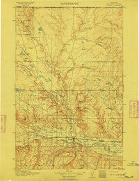
~ Zurich MT topo map, 1:125000 scale, 30 X 30 Minute, Historical, 1912
Zurich, Montana, USGS topographic map dated 1912.
Includes geographic coordinates (latitude and longitude). This topographic map is suitable for hiking, camping, and exploring, or framing it as a wall map.
Printed on-demand using high resolution imagery, on heavy weight and acid free paper, or alternatively on a variety of synthetic materials.
Topos available on paper, Waterproof, Poly, or Tyvek. Usually shipping rolled, unless combined with other folded maps in one order.
- Product Number: USGS-5685859
- Free digital map download (high-resolution, GeoPDF): Zurich, Montana (file size: 9 MB)
- Map Size: please refer to the dimensions of the GeoPDF map above
- Weight (paper map): ca. 55 grams
- Map Type: POD USGS Topographic Map
- Map Series: HTMC
- Map Verison: Historical
- Cell ID: 320708
- Scan ID: 268647
- Survey Year: 1909
- Datum: Unstated
- Map Projection: Unstated
- Map published by United States Geological Survey
- Keywords: Overedge with No Adjacent Map
- Map Language: English
- Scanner Resolution: 600 dpi
- Map Cell Name: Zurich
- Grid size: 30 X 30 Minute
- Date on map: 1912
- Map Scale: 1:125000
- Geographical region: Montana, United States
Neighboring Maps:
All neighboring USGS topo maps are available for sale online at a variety of scales.
Spatial coverage:
Topo map Zurich, Montana, covers the geographical area associated the following places:
- Minnesota Settlement (historical) - North Fork - Hollandville (historical) - Lohman - Norheim (historical) - Cherry Ridge (historical) - Elloam (historical) - Zurich - Sprinkle Trailer Court - Chinook - Burns Trailer Court
- Map Area ID: AREA4948.5-109.5-109
- Northwest corner Lat/Long code: USGSNW49-109.5
- Northeast corner Lat/Long code: USGSNE49-109
- Southwest corner Lat/Long code: USGSSW48.5-109.5
- Southeast corner Lat/Long code: USGSSE48.5-109
- Northern map edge Latitude: 49
- Southern map edge Latitude: 48.5
- Western map edge Longitude: -109.5
- Eastern map edge Longitude: -109


