
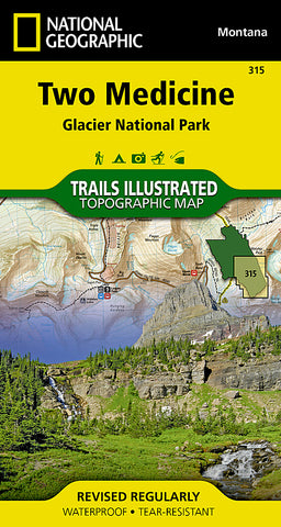

Glacier National Park, Two Medicine by National Geographic Maps
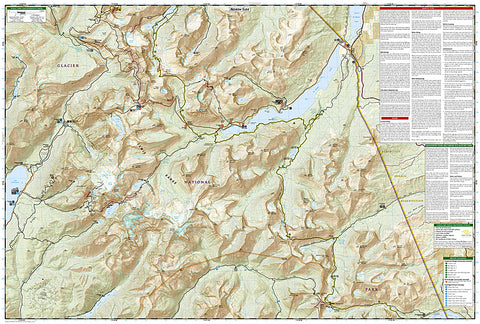
National Geographics Trails Illustrated map of Two Medicine delivers unmatched detail and valuable information to assist you year-round in your exploration of southeastern Glacier National Park. Expertly researched and created in partnership with local land management agencies, this map includes helpful contact information, backcountry hiking and camping tips and regulations, snow hazard areas, safety tips, and more. The map features many key areas of interest including John Stevens Canyon, St. Marys Lake, Lake McDonald and the historic Going-to-the-Sun road.
With clearly marked trails, suspension bridges, plank bridges and unbridged stream crossing, as well as contour lines and elevations for summits, this map will prove invaluable in your exploration of the area in all seasons. The map also includes the shuttle routes and stops for both the Lake McDonald and St. Marys Valley Shuttles for those wanting to explore the Going-to-the-Sun road without a car. Recreational features such as campgrounds, picnic areas, ski areas, boat rentals/river access points and trailheads are clearly marked as well.
Every Trails Illustrated map is printed on Backcountry Tough waterproof, tear-resistant paper. A full UTM grid is printed on the map to aid with GPS navigation.
Other features found on this map include: Flathead National Forest, Glacier, Great Bear Wilderness, Lewis & Clark National Forest, Mount Saint Nicholas, Mount Stimson, Saint Mary Lake.
- Product Number: 2034599M
- Product Code: TI_TWO_MEDICI
- Publisher Product ID: TI00000315
- ISBN: 9781566954716
- Year of Publication: 2009
- Folded Size: 7.48 x 4.33 inches
- Unfolded Size: 24.61 x 36.22 inches
- Map type: Folded Map
- Geographical region: Montana


