
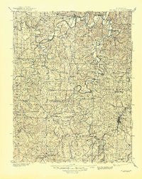
~ Hillsboro MO topo map, 1:125000 scale, 30 X 30 Minute, Historical, 1901, updated 1945
Hillsboro, Missouri, USGS topographic map dated 1901.
Includes geographic coordinates (latitude and longitude). This topographic map is suitable for hiking, camping, and exploring, or framing it as a wall map.
Printed on-demand using high resolution imagery, on heavy weight and acid free paper, or alternatively on a variety of synthetic materials.
Topos available on paper, Waterproof, Poly, or Tyvek. Usually shipping rolled, unless combined with other folded maps in one order.
- Product Number: USGS-8618480
- Free digital map download (high-resolution, GeoPDF): Hillsboro, Missouri (file size: 10 MB)
- Map Size: please refer to the dimensions of the GeoPDF map above
- Weight (paper map): ca. 55 grams
- Map Type: POD USGS Topographic Map
- Map Series: HTMC
- Map Verison: Historical
- Cell ID: 65680
- Scan ID: 325471
- Imprint Year: 1945
- Survey Year: 1896
- Datum: Unstated
- Map Projection: Polyconic
- Map published by United States Geological Survey
- Map Language: English
- Scanner Resolution: 600 dpi
- Map Cell Name: Hillsboro
- Grid size: 30 X 30 Minute
- Date on map: 1901
- Map Scale: 1:125000
- Geographical region: Missouri, United States
Neighboring Maps:
All neighboring USGS topo maps are available for sale online at a variety of scales.
Spatial coverage:
Topo map Hillsboro, Missouri, covers the geographical area associated the following places:
- Catawissa - Pacific - Mount Freedom - Hensley - Goldman - Villa Ridge - Moselle - Racola - Hurricane - Ebo - Robertsville - Mud Town - Richwoods - Cedar Hill - Victoria - Maddens Richwoods - Huff - Fletcher - Maupin - Echo Lake Ranch - Robidoux - Local - Melzo - Pohlman Mill - Parkdale - Ware - De Soto - Saint Clair - Weber Hill - Cedar Hill Lakes - The Diamonds - Ashland (historical) - Calvey (historical) - Fertile - Tiff - Rockford Beach - Oermann - Bliss - Otto - Cannon Mines - Granada Meadows - Hoene Spring - Prater - Fourche a Renault (historical) - Parkway - Aptus - Bellefontaine - Theabeau Town - George (historical) - Scotsdale - One Hundred and One Ranch - Cruise Mill - High Ridge - Shibboleth - Gray Summit - Hillsboro - Grubville - Dittmer - Cottage Farm - Morse Mill - Hemker - Belews Creek - Baryties - House Springs - Lonedell - Meramec Terrace - Mount Hope - Byrnesville - Vineland - Byrnes Mill - Gildehouse - La Barque Creek - Cedar Hill Manor - Old Mines - Plum Ford - Blackwell - Piney Park - Luebbering - Happy Hollow - Northcut - Frumet - Rabbitville - Regina
- Map Area ID: AREA38.538-91-90.5
- Northwest corner Lat/Long code: USGSNW38.5-91
- Northeast corner Lat/Long code: USGSNE38.5-90.5
- Southwest corner Lat/Long code: USGSSW38-91
- Southeast corner Lat/Long code: USGSSE38-90.5
- Northern map edge Latitude: 38.5
- Southern map edge Latitude: 38
- Western map edge Longitude: -91
- Eastern map edge Longitude: -90.5


