
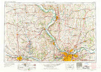
~ Kansas City MO topo map, 1:250000 scale, 1 X 2 Degree, Historical, 1956, updated 1967
Kansas City, Missouri, USGS topographic map dated 1956.
Includes geographic coordinates (latitude and longitude). This topographic map is suitable for hiking, camping, and exploring, or framing it as a wall map.
Printed on-demand using high resolution imagery, on heavy weight and acid free paper, or alternatively on a variety of synthetic materials.
Topos available on paper, Waterproof, Poly, or Tyvek. Usually shipping rolled, unless combined with other folded maps in one order.
- Product Number: USGS-5575884
- Free digital map download (high-resolution, GeoPDF): Kansas City, Missouri (file size: 21 MB)
- Map Size: please refer to the dimensions of the GeoPDF map above
- Weight (paper map): ca. 55 grams
- Map Type: POD USGS Topographic Map
- Map Series: HTMC
- Map Verison: Historical
- Cell ID: 68851
- Scan ID: 325599
- Imprint Year: 1967
- Woodland Tint: Yes
- Edit Year: 1966
- Field Check Year: 1956
- Datum: Unstated
- Map Projection: Transverse Mercator
- Map published by United States Army Corps of Engineers
- Map published by United States Army
- Map Language: English
- Scanner Resolution: 600 dpi
- Map Cell Name: Kansas City
- Grid size: 1 X 2 Degree
- Date on map: 1956
- Map Scale: 1:250000
- Geographical region: Missouri, United States
Neighboring Maps:
All neighboring USGS topo maps are available for sale online at a variety of scales.
Spatial coverage:
Topo map Kansas City, Missouri, covers the geographical area associated the following places:
- Belmont - Haydite - Pink Hill - Clear Creek Court Mobile Home Park - Elkhorn - Wildwoods Mobile Home Park - Troy - Greenville - Matney - Sunflower - North Moor - Hiatt - Palermo - Moors - Evanston - Altamont - Maple Garden - Camden Junction - Big Springs - Edgerton Junction - Glenaire - Paradise Mobile Home Park - Pomeroy - Maple Hill - Rock Creek - Countryside Home Park Mobile Home Park - Edwardsville - Gower - Ripley - Crystal Lakes - Westbridge - Kansas City - Woodruff - Arley - Mayetta - Stone - Chick (historical) - Quivira Hills Estates Mobile Home Park - Potter - Purcell - Ontario - Alta Vista - Fairport - Haynesville - Napoleon - Gashland - Garrettsburg - White Cloud - North Kansas City - Maysville - New Market - Westwood - Nodaway - Trimble - Iowa Point - Adams - Lathrop - Morrill - Lake of the Forest - Eton - Mission Hills - Gaslight Mobile Home Park - North Valley Mobile Home Village - Tecumseh - Frazier - Stockdale - Hilldale - Farley - Horton - Whiting - Prairie Ridge - Minneville - Atchison - Elwood - Halleck - Richardson - Kansas City - Maywood - Homestead - England Mobile Home Estates - Osborn - Reno - Creekside Estates Mobile Home Park - Claysville - Bayfield (historical) - Amazonia - Clair - Claycomo - Bern - Fairfax - Caravan Mobile Park - Effingham - Acme - Wilcox Court Mobile Home Park - Milton - Fairview - Rayville - Northern Heights - Turner - Bates City
- Map Area ID: AREA4039-96-94
- Northwest corner Lat/Long code: USGSNW40-96
- Northeast corner Lat/Long code: USGSNE40-94
- Southwest corner Lat/Long code: USGSSW39-96
- Southeast corner Lat/Long code: USGSSE39-94
- Northern map edge Latitude: 40
- Southern map edge Latitude: 39
- Western map edge Longitude: -96
- Eastern map edge Longitude: -94


