
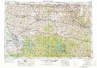
~ Jefferson City MO topo map, 1:250000 scale, 1 X 2 Degree, Historical, 1955, updated 1973
Jefferson City, Missouri, USGS topographic map dated 1955.
Includes geographic coordinates (latitude and longitude). This topographic map is suitable for hiking, camping, and exploring, or framing it as a wall map.
Printed on-demand using high resolution imagery, on heavy weight and acid free paper, or alternatively on a variety of synthetic materials.
Topos available on paper, Waterproof, Poly, or Tyvek. Usually shipping rolled, unless combined with other folded maps in one order.
- Product Number: USGS-5575862
- Free digital map download (high-resolution, GeoPDF): Jefferson City, Missouri (file size: 25 MB)
- Map Size: please refer to the dimensions of the GeoPDF map above
- Weight (paper map): ca. 55 grams
- Map Type: POD USGS Topographic Map
- Map Series: HTMC
- Map Verison: Historical
- Cell ID: 68843
- Scan ID: 325589
- Imprint Year: 1973
- Woodland Tint: Yes
- Aerial Photo Year: 1950
- Edit Year: 1970
- Field Check Year: 1955
- Datum: Unstated
- Map Projection: Transverse Mercator
- Map published by United States Army Corps of Engineers
- Map published by United States Army
- Map Language: English
- Scanner Resolution: 600 dpi
- Map Cell Name: Jefferson City
- Grid size: 1 X 2 Degree
- Date on map: 1955
- Map Scale: 1:250000
- Geographical region: Missouri, United States
Neighboring Maps:
All neighboring USGS topo maps are available for sale online at a variety of scales.
Spatial coverage:
Topo map Jefferson City, Missouri, covers the geographical area associated the following places:
- Hartwell - Marvin - Englewood - Koeltztown - Lisletown (historical) - White Cloud - Browns Ford - Wainwright - Pleasant Green - Quarles - Claysville - Dixie - Blackwater - Guthrie - Harper - Pertle Springs - Etterville - California - Osage Bluff - Bellair - Dell Junction - Versailles - Crockerville - Linn Creek - Schubert - Cole Camp - Syracuse - Henley - Van Cleve - Centerview - Tedieville - Iuka Springs - Pleasant Grove - Hoecker - Decatur - Cornelia - Aurora Springs - Consville (historical) - Faith - Green Ridge - Huntsdale - Sutherland - Delmar - Bannister - Hurricane Deck - Osceola - Stonesport (historical) - Brownington - Taberville - Clarks Fork - Magnolia - Bacon - Capps - Pisgah - Argyle - New Lebanon - Boylers Mill - Fayetteville - Wooldridge - Racket - Scrivner - Saint Anthony - Santiago - Petersburg - Emma - Bannister Ford - Midway - La Due - Elston - Ernestville - McGirk - Centertown - Harg - Todd (historical) - Maurine - McAllister Springs - Hortense - Babbtown - Big Bend Acres - Scruggs - Prairie Home - Bahner - Robbins - Nashville (historical) - Finey - Mount Olive - Sudheimer - Windsor - Hastain - Overton - Saint Martins - Aikinsville - Shawnee Mound - Buck Creek - Wisdom - Stokley - Beaman - Oldham - Saint Thomas - Rocheport
- Map Area ID: AREA3938-94-92
- Northwest corner Lat/Long code: USGSNW39-94
- Northeast corner Lat/Long code: USGSNE39-92
- Southwest corner Lat/Long code: USGSSW38-94
- Southeast corner Lat/Long code: USGSSE38-92
- Northern map edge Latitude: 39
- Southern map edge Latitude: 38
- Western map edge Longitude: -94
- Eastern map edge Longitude: -92


