
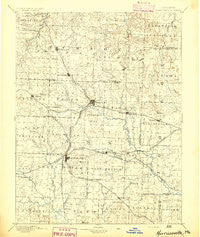
~ Harrisonville MO topo map, 1:125000 scale, 30 X 30 Minute, Historical, 1894
Harrisonville, Missouri, USGS topographic map dated 1894.
Includes geographic coordinates (latitude and longitude). This topographic map is suitable for hiking, camping, and exploring, or framing it as a wall map.
Printed on-demand using high resolution imagery, on heavy weight and acid free paper, or alternatively on a variety of synthetic materials.
Topos available on paper, Waterproof, Poly, or Tyvek. Usually shipping rolled, unless combined with other folded maps in one order.
- Product Number: USGS-5575632
- Free digital map download (high-resolution, GeoPDF): Harrisonville, Missouri (file size: 7 MB)
- Map Size: please refer to the dimensions of the GeoPDF map above
- Weight (paper map): ca. 55 grams
- Map Type: POD USGS Topographic Map
- Map Series: HTMC
- Map Verison: Historical
- Cell ID: 65650
- Scan ID: 325463
- Survey Year: 1885
- Datum: Unstated
- Map Projection: Unstated
- Map published by United States Geological Survey
- Map Language: English
- Scanner Resolution: 600 dpi
- Map Cell Name: Harrisonville
- Grid size: 30 X 30 Minute
- Date on map: 1894
- Map Scale: 1:125000
- Geographical region: Missouri, United States
Neighboring Maps:
All neighboring USGS topo maps are available for sale online at a variety of scales.
Spatial coverage:
Topo map Harrisonville, Missouri, covers the geographical area associated the following places:
- Unity Village - Hicks City - Rockford (historical) - Sni Mills - Baldwin Park - Longview - Fenwick - Delavan (historical) - Lone Jack - Avon - Austin - Lees Summit - Raymore - Harrisonville - Tarsney Lakes - Lake Lotawana - Peculiar - Old Peculiar - Cockrell - Quick City - South Lee - Knobtown - Pleasant Hill - Strasburg - Wyoming (historical) - Kingsville - Elm - Medford - Wingate - Garden City - Gunn City - Rose Hill - Oviet (historical) - Everett - Fulkerson - Little Blue - Hadsell - Tarsney - Cause Prairie (historical) - Union Point - Daugherty - Harrelson - Latour - Gowdy - Prettyman - Ore - Greenwood - Chapel Hill - Huber - Coleman - Rural Home (historical) - East Lynne - Lake Winnebago - Lone Tree - Vale
- Map Area ID: AREA3938.5-94.5-94
- Northwest corner Lat/Long code: USGSNW39-94.5
- Northeast corner Lat/Long code: USGSNE39-94
- Southwest corner Lat/Long code: USGSSW38.5-94.5
- Southeast corner Lat/Long code: USGSSE38.5-94
- Northern map edge Latitude: 39
- Southern map edge Latitude: 38.5
- Western map edge Longitude: -94.5
- Eastern map edge Longitude: -94


