
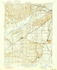
~ Advance MO topo map, 1:62500 scale, 15 X 15 Minute, Historical, 1934, updated 1950
Advance, Missouri, USGS topographic map dated 1934.
Includes geographic coordinates (latitude and longitude). This topographic map is suitable for hiking, camping, and exploring, or framing it as a wall map.
Printed on-demand using high resolution imagery, on heavy weight and acid free paper, or alternatively on a variety of synthetic materials.
Topos available on paper, Waterproof, Poly, or Tyvek. Usually shipping rolled, unless combined with other folded maps in one order.
- Product Number: USGS-5574266
- Free digital map download (high-resolution, GeoPDF): Advance, Missouri (file size: 8 MB)
- Map Size: please refer to the dimensions of the GeoPDF map above
- Weight (paper map): ca. 55 grams
- Map Type: POD USGS Topographic Map
- Map Series: HTMC
- Map Verison: Historical
- Cell ID: 64821
- Scan ID: 324677
- Imprint Year: 1950
- Edit Year: 1950
- Survey Year: 1931
- Datum: NAD
- Map Projection: Polyconic
- Map published by United States Geological Survey
- Map published by United States Army Corps of Engineers
- Map Language: English
- Scanner Resolution: 600 dpi
- Map Cell Name: Advance
- Grid size: 15 X 15 Minute
- Date on map: 1934
- Map Scale: 1:62500
- Geographical region: Missouri, United States
Neighboring Maps:
All neighboring USGS topo maps are available for sale online at a variety of scales.
Spatial coverage:
Topo map Advance, Missouri, covers the geographical area associated the following places:
- Toga - Glennon - Stroderville (historical) - Rum Branch - Messler - Arbor - Cliff - Swinton - Advance - Castor - Painton - Brownwood - Schlatitz - Bell City - Randles - Heagy - Tillman - Allenville - Whitewater - Perkins - Green Cox - Drum - Dongola - Hickory Ridge - Ardeola
- Map Area ID: AREA37.2537-90-89.75
- Northwest corner Lat/Long code: USGSNW37.25-90
- Northeast corner Lat/Long code: USGSNE37.25-89.75
- Southwest corner Lat/Long code: USGSSW37-90
- Southeast corner Lat/Long code: USGSSE37-89.75
- Northern map edge Latitude: 37.25
- Southern map edge Latitude: 37
- Western map edge Longitude: -90
- Eastern map edge Longitude: -89.75


