
~ Greenwood MS topo map, 1:250000 scale, 1 X 2 Degree, Historical, 1956, updated 1956
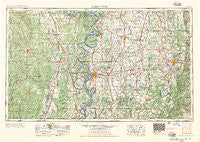
Greenwood, Mississippi, USGS topographic map dated 1956.
Includes geographic coordinates (latitude and longitude). This topographic map is suitable for hiking, camping, and exploring, or framing it as a wall map.
Printed on-demand using high resolution imagery, on heavy weight and acid free paper, or alternatively on a variety of synthetic materials.
Topos available on paper, Waterproof, Poly, or Tyvek. Usually shipping rolled, unless combined with other folded maps in one order.
- Product Number: USGS-5599052
- Free digital map download (high-resolution, GeoPDF): Greenwood, Mississippi (file size: 25 MB)
- Map Size: please refer to the dimensions of the GeoPDF map above
- Weight (paper map): ca. 55 grams
- Map Type: POD USGS Topographic Map
- Map Series: HTMC
- Map Verison: Historical
- Cell ID: 68809
- Scan ID: 337252
- Imprint Year: 1956
- Woodland Tint: Yes
- Field Check Year: 1953
- Datum: Unstated
- Map Projection: Transverse Mercator
- Map published by United States Army Corps of Engineers
- Map published by United States Army
- Map Language: English
- Scanner Resolution: 600 dpi
- Map Cell Name: Greenwood
- Grid size: 1 X 2 Degree
- Date on map: 1956
- Map Scale: 1:250000
- Geographical region: Mississippi, United States
Neighboring Maps:
All neighboring USGS topo maps are available for sale online at a variety of scales.
Spatial coverage:
Topo map Greenwood, Mississippi, covers the geographical area associated the following places:
- Dulweber - Meltonia - Scrouge Out (historical) - Woodside - Hickory Ridge - Panther Burn - Halley - Mount Pleasant - Chicot - Saline (historical) - Glendale - Martinville - Sago - Minter City - Doddsville - Rixwood - Romeo - Goose Hollow - Richland - Berclair - Waltonia (historical) - Kongo - Oklahoma - Beech Creek Crossing - Pine Grove - Choctaw Village (historical) - Warsaw - Pace - Roark - Alder Grove (historical) - Cornerville - Pine Land - Bowman - Perthshire - Chicot Junction - Eudora - Howard - Fresno - Quofaloma - Elmwood - Marksville - Leflore - Oakwoods (historical) - Cremer - Wade (historical) - Niles - Lebanon - Jersey Point - Chanticleer - Silver City - Merigold - Overby - Powell Bayou - Troy (historical) - Nelia (historical) - Star City - Metcalfe - Lone Sasafras (historical) - O'Reilly - Oxberry - Rosedale - Tribbett - Nichols - Mount Olive - Mattoon - Lobdell - Whaley - Napanee - Riley - Flautt - Roebuck - Updike - McGrath - Stephenville - Gooden Lake - Brooklyn - Vinson (historical) - Longview Crossing - Vaucluse - Eastland - South Crossett - Champion (historical) - Acona - Watson - Mills - James - Beulah - Fort Loring Landing - Hatten - Blaine - Valley Junction - Estill - Snyder - Pentecost - Mayday - Halley Junction - Winstonville - Lucca Landing - Crigler - Kinlock
- Map Area ID: AREA3433-92-90
- Northwest corner Lat/Long code: USGSNW34-92
- Northeast corner Lat/Long code: USGSNE34-90
- Southwest corner Lat/Long code: USGSSW33-92
- Southeast corner Lat/Long code: USGSSE33-90
- Northern map edge Latitude: 34
- Southern map edge Latitude: 33
- Western map edge Longitude: -92
- Eastern map edge Longitude: -90


