
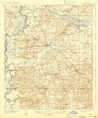
~ Florence MS topo map, 1:62500 scale, 15 X 15 Minute, Historical, 1908, updated 1942
Florence, Mississippi, USGS topographic map dated 1908.
Includes geographic coordinates (latitude and longitude). This topographic map is suitable for hiking, camping, and exploring, or framing it as a wall map.
Printed on-demand using high resolution imagery, on heavy weight and acid free paper, or alternatively on a variety of synthetic materials.
Topos available on paper, Waterproof, Poly, or Tyvek. Usually shipping rolled, unless combined with other folded maps in one order.
- Product Number: USGS-5598424
- Free digital map download (high-resolution, GeoPDF): Florence, Mississippi (file size: 9 MB)
- Map Size: please refer to the dimensions of the GeoPDF map above
- Weight (paper map): ca. 55 grams
- Map Type: POD USGS Topographic Map
- Map Series: HTMC
- Map Verison: Historical
- Cell ID: 54199
- Scan ID: 336904
- Imprint Year: 1942
- Survey Year: 1906
- Datum: Unstated
- Map Projection: Polyconic
- Map published by United States Geological Survey
- Map Language: English
- Scanner Resolution: 600 dpi
- Map Cell Name: Florence
- Grid size: 15 X 15 Minute
- Date on map: 1908
- Map Scale: 1:62500
- Geographical region: Mississippi, United States
Neighboring Maps:
All neighboring USGS topo maps are available for sale online at a variety of scales.
Spatial coverage:
Topo map Florence, Mississippi, covers the geographical area associated the following places:
- Pat - Florence - Cleary Heights - Star - Red Hill - Whites - Lakeland - Lotts Mobile Home Park - Byram - Greenfield - Taylorsville - Southwood Estates - Cleary - Comeby (historical) - Elton Place - Warren Place - Whitfield - Alonzo - Mayfair - Thomasville - Plain - Elton - Pearson - Linden (historical) - Sinai - Gama - Mountain Creek (historical) - Rexford - Anse - Plainview - Howell (historical) - Nogan - Monterey - Choctaw Village - Richmond (historical) - Dane (historical) - Cedar Point - Clear Branch - Richland - King - Richland Estates - Pearl
- Map Area ID: AREA32.2532-90.25-90
- Northwest corner Lat/Long code: USGSNW32.25-90.25
- Northeast corner Lat/Long code: USGSNE32.25-90
- Southwest corner Lat/Long code: USGSSW32-90.25
- Southeast corner Lat/Long code: USGSSE32-90
- Northern map edge Latitude: 32.25
- Southern map edge Latitude: 32
- Western map edge Longitude: -90.25
- Eastern map edge Longitude: -90


