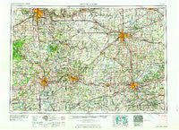
~ Grand Rapids MI topo map, 1:250000 scale, 1 X 2 Degree, Historical, 1962
Grand Rapids, Michigan, USGS topographic map dated 1962.
Includes geographic coordinates (latitude and longitude). This topographic map is suitable for hiking, camping, and exploring, or framing it as a wall map.
Printed on-demand using high resolution imagery, on heavy weight and acid free paper, or alternatively on a variety of synthetic materials.
Topos available on paper, Waterproof, Poly, or Tyvek. Usually shipping rolled, unless combined with other folded maps in one order.
- Product Number: USGS-5443728
- Free digital map download (high-resolution, GeoPDF): Grand Rapids, Michigan (file size: 22 MB)
- Map Size: please refer to the dimensions of the GeoPDF map above
- Weight (paper map): ca. 55 grams
- Map Type: POD USGS Topographic Map
- Map Series: HTMC
- Map Verison: Historical
- Cell ID: 68801
- Scan ID: 278736
- Woodland Tint: Yes
- Field Check Year: 1958
- Datum: Unstated
- Map Projection: Transverse Mercator
- Map published by United States Geological Survey
- Map Language: English
- Scanner Resolution: 600 dpi
- Map Cell Name: Grand Rapids
- Grid size: 1 X 2 Degree
- Date on map: 1962
- Map Scale: 1:250000
- Geographical region: Michigan, United States
Neighboring Maps:
All neighboring USGS topo maps are available for sale online at a variety of scales.
Spatial coverage:
Topo map Grand Rapids, Michigan, covers the geographical area associated the following places:
- Howardsville - Fallassburg - Girard - Fowlerville - Onondaga - Tallmadge - Century Park Mobile Home Park - Imperial Mobile Homes - Alamo - Shady Brook Mobile Home Park - South Ionia - Millgrove - Mason - Otsego - East Cooper - Eaton Rapids - Ceresco - Meridian - Adams Park - Woodville - Almena - Williamston - South Riley - Old Mill Gardens - Carlton - Pittsburg - Cozy Mobile Home Community - Portage - Schoolcraft - Nicholsville - Athens - Maplehurst - Homer - Dowling - Bennington - Pulaski - Kentwood - Creekside Estates Mobile Home Park - Hi-Way Mobile Haven - Kerby - Coats Grove - Roots - Sharon Hollow - Albion - Rotunda Mobile Home Park - Waverly - Country Acres Village Mobile Home Park - Urbandale - North Aurelius - Texas Corners - Kendall - Freeport - Laingsburg - Aurelius - North Byron - Price - Chelsea - Sunrise Mobile Home Park - Collins Corner - Chalkerville - Marcellus - Thunderbird Mobile Village - Charlotte - Midland Park - Brownlee Park - Alto - Sun Valley Mobile Home Estates - Okemos - Stockbridge - Algonquin Lake Trailer Court - Valley Vista Mobile Home Park - Oak Brook Estates Mobile Home Park - Whitneyville - Clarklake - Three Oaks Estates Mobile Home Park - Vinings Trailer Park - Parmelee - Dutton - Sunset View Mobile Home Park - Richland Junction - DeWitt - Owosso - Merlino's Hidden Valley Estates Mobile Home Park - Kinneville - Burnips - Millville - Dutch Mills Mobile Home Park - Hanover Village Apartments Mobile Home Park - Mattawan - Sherman Oaks Mobile Park - Burlington - Oak Brook Estates Mobile Home Park - Saranac - Climax - Carlisle - Hunters Glen Mobile Home Park - Franklin Valley Estates Mobile Home Park - Country Manor Mobile Home Park - Cider Mill Village Mobile Home Community - Vickery Landing
- Map Area ID: AREA4342-86-84
- Northwest corner Lat/Long code: USGSNW43-86
- Northeast corner Lat/Long code: USGSNE43-84
- Southwest corner Lat/Long code: USGSSW42-86
- Southeast corner Lat/Long code: USGSSE42-84
- Northern map edge Latitude: 43
- Southern map edge Latitude: 42
- Western map edge Longitude: -86
- Eastern map edge Longitude: -84

