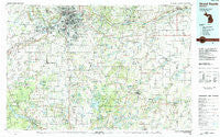
~ Grand Rapids MI topo map, 1:100000 scale, 30 X 60 Minute, Historical, 1984, updated 1984
Grand Rapids, Michigan, USGS topographic map dated 1984.
Includes geographic coordinates (latitude and longitude). This topographic map is suitable for hiking, camping, and exploring, or framing it as a wall map.
Printed on-demand using high resolution imagery, on heavy weight and acid free paper, or alternatively on a variety of synthetic materials.
Topos available on paper, Waterproof, Poly, or Tyvek. Usually shipping rolled, unless combined with other folded maps in one order.
- Product Number: USGS-5443582
- Free digital map download (high-resolution, GeoPDF): Grand Rapids, Michigan (file size: 29 MB)
- Map Size: please refer to the dimensions of the GeoPDF map above
- Weight (paper map): ca. 55 grams
- Map Type: POD USGS Topographic Map
- Map Series: HTMC
- Map Verison: Historical
- Cell ID: 67597
- Scan ID: 278656
- Imprint Year: 1984
- Woodland Tint: Yes
- Aerial Photo Year: 1980
- Edit Year: 1984
- Datum: NAD27
- Map Projection: Universal Transverse Mercator
- Map published by United States Geological Survey
- Map Language: English
- Scanner Resolution: 600 dpi
- Map Cell Name: Grand Rapids
- Grid size: 30 X 60 Minute
- Date on map: 1984
- Map Scale: 1:100000
- Geographical region: Michigan, United States
Neighboring Maps:
All neighboring USGS topo maps are available for sale online at a variety of scales.
Spatial coverage:
Topo map Grand Rapids, Michigan, covers the geographical area associated the following places:
- Monterey Center - Alto - Homecrest Villa Mobile Home Park - Sandy Pines - Holiday Gardens Mobile Home Park - Dutton Mill Village Mobile Home Park - Forest Grove - Prairie - Brookside Village Mobile Home Park - Green Lake - Segwun - Maple Grove - Cutlerville - Canterbury Estates Mobile Home Park - Wyoming - Knollwood Estates Mobile Home Park - Presidential Estates Mobile Home Park - Kalamo - Lake Odessa - Tallmadge - Byron Center - Holy Corners - Hooper - Qumby - Creekside Estates Mobile Home Park - Whitneyville - Byron Center Mobile Village - Zutphen - Oakland - Hilliards - South Monterey - Schultz - Forest Hills - South Ionia - Neeley - Hastings - Brookside Meadows Community Mobile Home Park - Shady Acres Mobile Home Park - Elmdale - Alaska - McCords - Brentwood Mobile Village - Logan Estates Mobile Home Park - Woodbury - Hopkins - New Salem - Prairieville - Cloverdale - Kentwood - South Blendon - Chateau Ferrand Estates Mobile Home Park - Orangeville - Dunningville - Pearline - Barry's Resort and Mobile Home Park - Bowne Center - Bauer - Green Lake - Ross - Guernsey Lake Mobile Home Court - Standale - Paris Estates Mobile Home Park - Campbell Corners - Caledonia - North Byron - Bowens Mill - Country Hills Village Mobile Home Park - Carlton - Key Heights Village Mobile Home Park - Little Gem Mobile Home Court - Hunters Glen Mobile Home Park - Allendale Meadows Mobile Park - Jenison - Monteith Station - Moline - Circle Pine Center - Dowling - Southwood Village Mobile Home Park - Allegan Mobile Estates - Portage Terrace Mobile Home Park - Hudsonville - Podunk - Freeport - Berlin Center - Watson - Vermontville - Cedar Creek - Coats Grove - Allegan - Windsor Woods Village Mobile Home Park - Windmill Pointe Mobile Home Park - Bradley - Ada - Thornapple Lake Estates Mobile Home Park - Beaverdam - Clarksville - Tremaine Corners - East Grand Rapids - Vriesland - Drenthe
- Map Area ID: AREA4342.5-86-85
- Northwest corner Lat/Long code: USGSNW43-86
- Northeast corner Lat/Long code: USGSNE43-85
- Southwest corner Lat/Long code: USGSSW42.5-86
- Southeast corner Lat/Long code: USGSSE42.5-85
- Northern map edge Latitude: 43
- Southern map edge Latitude: 42.5
- Western map edge Longitude: -86
- Eastern map edge Longitude: -85

