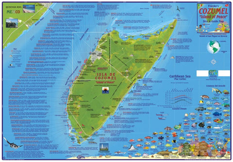
Caribbean Map, Cozumel Dive and Guide, laminated, 2010 by Frankos Maps Ltd.
Frankos Map of Cozumel, an island just off the Yucatan Peninsula of the state of Quintana Roo, Mexico, features a layout of Isla de Cozumel, based on nautical charts and aerial photos. Cozumels roads, Maya ruins, resorts, and other features are shown on side one. Most importantly, is the location and detailed descriptions of 55 scuba diving and snorkeling sites, which is how Cozumel gained its prestige and fame. It is noteworthy to say that Cozumel boasts some of the most outstanding scuba diving on Earth. One could claim that as many as five of the top ten scuba sites in the world are along Cozumels leeward (west) side. The descriptions of all the reefs/underwater walls, coral pinnacles and buttresses and coral gardens is briefly told for each one, and then on side two of the map there is a drawing and descriptions of these features in general. Frankos Map of Cozumel also shows a number of dive sites on the windward side of Cozumel, including El Islote, Playa Bush, El Mirador, Punta Chiqueros, Chen Rio, Punta Morena, Los Atolones and Islotes. For those who are interested, Cozumel also has a trio of notable surf spots, which are located on the map. They include Playa Bonita, Chen Rio and Mezcalitos. Cannons, anchors and other artifacts are found in the waters of Cozumel. Frankos Map of Cozumel shows a sampling of these items dating from the Spanish exploration era onward. Maya ruin sites, where there still can be found beautiful examples of former great cites in Cozumels interior are also located on this map. They include the famous and fabulous San Gervasio, El Cedral, Santa Rita, etc. Some folks travel to Cozumel just to see the ruins. The finishing touch on side one of Frankos Map of Cozumel is the Caribbean reef creatures guide. This biological interpretive data includes over 100 species of fish, invertebrates, corals and sponges, depicted in full color with names for easy identification.
Side 2 of Frankos Map of Cozumel features Greater San Miguel, which covers much of the west coast, from the Cozumel Country Club on the north to Chankanaab Marine National Park on the south. Chankanaab Park is also shown in detail. The locations of the dive spots defined on side one are more closely shown here. A few undersea photos of the reefs and sights highlight this map. Although this detail shows many of the hotels and resorts along Cozumels leeward side, the City of San Miguel itself deserves an even closer detail. And thus the Map of Downtown San Miguel was created. Many of Cozumels main dive shops are located in this detail, along with the citys main features, such as the cruise ship terminals, the route to the airport, Plaza San Miguel, hotels, and even grocery stores.
- Product Number: 2042511M
- Product Code: FM_COZUMEL_LAM
- ISBN: 9781601901095
- Year of Publication: 2010
- Unfolded Size: 17.72 x 25.98 inches
- Map type: Flat Map
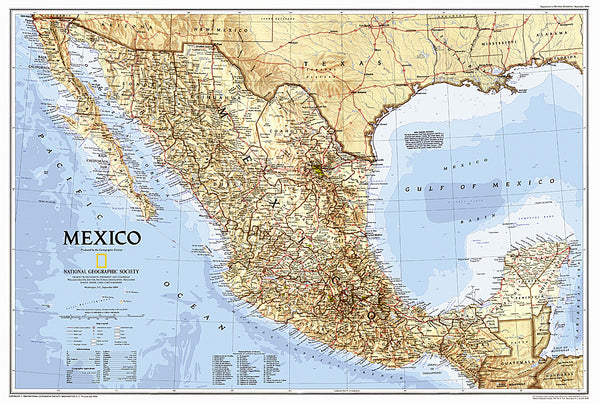
- Geographical region: Mexico