
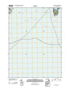
~ Hyannis OE S MA topo map, 1:24000 scale, 7.5 X 7.5 Minute, Historical, 2012
Hyannis OE S, Massachusetts, USGS topographic map dated 2012.
Includes geographic coordinates (latitude and longitude). This topographic map is suitable for hiking, camping, and exploring, or framing it as a wall map.
Printed on-demand using high resolution imagery, on heavy weight and acid free paper, or alternatively on a variety of synthetic materials.
Topos available on paper, Waterproof, Poly, or Tyvek. Usually shipping rolled, unless combined with other folded maps in one order.
- Product Number: USGS-5642283
- Free digital map download (high-resolution, GeoPDF): Hyannis OE S, Massachusetts (file size: 7 MB)
- Map Size: please refer to the dimensions of the GeoPDF map above
- Weight (paper map): ca. 55 grams
- Map Type: POD USGS Topographic Map
- Map Series: US Topo
- Map Verison: Historical
- Cell ID: 76315
- Datum: North American Datum of 1983
- Map Projection: Transverse Mercator
- Map Cell Name: Hyannis OE S
- Grid size: 7.5 X 7.5 Minute
- Date on map: 2012
- Map Scale: 1:24000
- Geographical region: Massachusetts, United States
Neighboring Maps:
All neighboring USGS topo maps are available for sale online at a variety of scales.
Spatial coverage:
Topo map Hyannis OE S, Massachusetts, covers the geographical area associated the following places:
- Hallets Rock - South West Rock - Great Island - Collier Ledge - Weequakut (historical) - Broken Ground - Gannet Ledge - Bearse Rock - Wianno Beach - Dowses Beach - Eddie Woods Rock - Bishop and Clerks - Great Rock - Halftide Rock - Southwest Rock - West South West Ledge - Phinneys Bay - Gannet Rocks - Hodges Rock - Middle Ledge (historical) - Southwest Ground - Hyannis Breakwater Light - Point Gammon - Channel Rock - Gardiners Rock - Crystal Lake - Gazelle Rock - Dead Neck Rock (historical) - The Spindle - Osterville Point
- Map Area ID: AREA41.62541.5-70.375-70.25
- Northwest corner Lat/Long code: USGSNW41.625-70.375
- Northeast corner Lat/Long code: USGSNE41.625-70.25
- Southwest corner Lat/Long code: USGSSW41.5-70.375
- Southeast corner Lat/Long code: USGSSE41.5-70.25
- Northern map edge Latitude: 41.625
- Southern map edge Latitude: 41.5
- Western map edge Longitude: -70.375
- Eastern map edge Longitude: -70.25


