
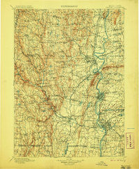
~ Holyoke MA topo map, 1:125000 scale, 30 X 30 Minute, Historical, 1901, updated 1906
Holyoke, Massachusetts, USGS topographic map dated 1901.
Includes geographic coordinates (latitude and longitude). This topographic map is suitable for hiking, camping, and exploring, or framing it as a wall map.
Printed on-demand using high resolution imagery, on heavy weight and acid free paper, or alternatively on a variety of synthetic materials.
Topos available on paper, Waterproof, Poly, or Tyvek. Usually shipping rolled, unless combined with other folded maps in one order.
- Product Number: USGS-5636129
- Free digital map download (high-resolution, GeoPDF): Holyoke, Massachusetts (file size: 11 MB)
- Map Size: please refer to the dimensions of the GeoPDF map above
- Weight (paper map): ca. 55 grams
- Map Type: POD USGS Topographic Map
- Map Series: HTMC
- Map Verison: Historical
- Cell ID: 65691
- Scan ID: 353190
- Imprint Year: 1906
- Survey Year: 1887
- Datum: Unstated
- Map Projection: Unstated
- Map published by United States Geological Survey
- Map Language: English
- Scanner Resolution: 600 dpi
- Map Cell Name: Holyoke
- Grid size: 30 X 30 Minute
- Date on map: 1901
- Map Scale: 1:125000
- Geographical region: Massachusetts, United States
Neighboring Maps:
All neighboring USGS topo maps are available for sale online at a variety of scales.
Spatial coverage:
Topo map Holyoke, Massachusetts, covers the geographical area associated the following places:
- O'Briens Corner - East Farms - Amherst Center - South Quarter - Brightside - Woronoco Heights - Hampton Village - Highlands - North Agawam - Liberty Heights - North Farms - Ringville - Norwich Bridge - East Windsor - Mount Tom - Mundale - Amherst - Mittineague - Paucatuck (historical) - East Forest Park - East Springfield - West Granville - East Whately - North Chester - Agawam - Sunderland - Plainville - Bay State - Mountain Park - Hubbard Corner - Great Swamp - Ashleyville - Duncan Knoll - Merrick - Tatham - Easthampton - Congamond - Plainville (historical) - Goshen - Swanson Corners - Vining Hill - Feeding Hills - Scott Corners - Springfield Hill - Loudville - Aldenville - Granville - Perry Manor - Chicopee Falls - Leverett - Pine Point - Bryant Four Corners - Lithia - Swift River - Fiberloid - Crescent Mills - Chester Center - Freeman Knoll - Holyoke - Dayville - Longmeadow - Haydenville - Roaring Brook Camp - Smith Highlands - McKnight and Bay - Old Hill - Crescent Grove (historical) - Camp Howe - Ebbs Corner - Springdale - West Hatfield - Williamsburg - West Farms - Worthington Center - Cadys Corners - Shea Corner - West Hartland - Athol Junction - Sixteen Acres - Chester - Worthington Corners - Woronoco - Wyben - The X - Baird Four Corners - Westhampton - Cummington - Moody Corner - Highland Park - Thermopylae - Oakdale - Little River - North Blandford - West Worthington - Rock Valley - Johnson Corner - North Thompsonville - Mathies Manor - Southampton - Russell
- Map Area ID: AREA42.542-73-72.5
- Northwest corner Lat/Long code: USGSNW42.5-73
- Northeast corner Lat/Long code: USGSNE42.5-72.5
- Southwest corner Lat/Long code: USGSSW42-73
- Southeast corner Lat/Long code: USGSSE42-72.5
- Northern map edge Latitude: 42.5
- Southern map edge Latitude: 42
- Western map edge Longitude: -73
- Eastern map edge Longitude: -72.5


