
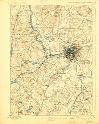
~ Lowell MA topo map, 1:62500 scale, 15 X 15 Minute, Historical, 1893, updated 1925
Lowell, Massachusetts, USGS topographic map dated 1893.
Includes geographic coordinates (latitude and longitude). This topographic map is suitable for hiking, camping, and exploring, or framing it as a wall map.
Printed on-demand using high resolution imagery, on heavy weight and acid free paper, or alternatively on a variety of synthetic materials.
Topos available on paper, Waterproof, Poly, or Tyvek. Usually shipping rolled, unless combined with other folded maps in one order.
- Product Number: USGS-5635635
- Free digital map download (high-resolution, GeoPDF): Lowell, Massachusetts (file size: 8 MB)
- Map Size: please refer to the dimensions of the GeoPDF map above
- Weight (paper map): ca. 55 grams
- Map Type: POD USGS Topographic Map
- Map Series: HTMC
- Map Verison: Historical
- Cell ID: 56947
- Scan ID: 352815
- Imprint Year: 1925
- Survey Year: 1886
- Datum: NAD
- Map Projection: Polyconic
- Map published by United States Geological Survey
- Map Language: English
- Scanner Resolution: 600 dpi
- Map Cell Name: Lowell
- Grid size: 15 X 15 Minute
- Date on map: 1893
- Map Scale: 1:62500
- Geographical region: Massachusetts, United States
Neighboring Maps:
All neighboring USGS topo maps are available for sale online at a variety of scales.
Spatial coverage:
Topo map Lowell, Massachusetts, covers the geographical area associated the following places:
- South Lowell - East Littleton - West Chelmsford - Long Pond Park - Bedford Springs - Dracut - Oaklands - North Billerica - Westlands - Flints Corner - South Chelmsford - Carlisle - Riverside - Chelmsford Center - Whidden Corner - North Chelmsford - Nabnasset - Rio Vista - River Pines - Nutting Lake - East Groton - Pelham - Centralville - Camp Immaculate Heart - Village of Nagog Woods - Camp Cielo Celeste - Camp Massapoag - Graniteville - Camp Wakitatina - Bleachery - Carlisle Station - Norris Corner - Chelmsford - New Town (historical) - Ayres City - Princeton Village - Lowell - North Acton - Frederick Corner - Hayward Corner - Centre Village (historical) - Ward Corner - Boxboro Station - Dunstable - Swan Corner - Pawtucketville - Camp Nashoba - South Billerica - Middlesex Village - Billerica - Varnumtown - Westford - Forge Village - Belvidere - Parkerville - Westford Station - Highlands - Tyngsboro - Wamesit - Camp Kiwanis - Kenwood - Brookside Station - Littleton Common - Collinsville - Willowdale
- Map Area ID: AREA42.7542.5-71.5-71.25
- Northwest corner Lat/Long code: USGSNW42.75-71.5
- Northeast corner Lat/Long code: USGSNE42.75-71.25
- Southwest corner Lat/Long code: USGSSW42.5-71.5
- Southeast corner Lat/Long code: USGSSE42.5-71.25
- Northern map edge Latitude: 42.75
- Southern map edge Latitude: 42.5
- Western map edge Longitude: -71.5
- Eastern map edge Longitude: -71.25


