
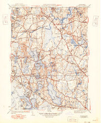
~ Hanover MA topo map, 1:31680 scale, 7.5 X 7.5 Minute, Historical, 1940, updated 1949
Hanover, Massachusetts, USGS topographic map dated 1940.
Includes geographic coordinates (latitude and longitude). This topographic map is suitable for hiking, camping, and exploring, or framing it as a wall map.
Printed on-demand using high resolution imagery, on heavy weight and acid free paper, or alternatively on a variety of synthetic materials.
Topos available on paper, Waterproof, Poly, or Tyvek. Usually shipping rolled, unless combined with other folded maps in one order.
- Product Number: USGS-5634319
- Free digital map download (high-resolution, GeoPDF): Hanover, Massachusetts (file size: 10 MB)
- Map Size: please refer to the dimensions of the GeoPDF map above
- Weight (paper map): ca. 55 grams
- Map Type: POD USGS Topographic Map
- Map Series: HTMC
- Map Verison: Historical
- Cell ID: 19225
- Scan ID: 351777
- Imprint Year: 1949
- Edit Year: 1948
- Survey Year: 1935
- Datum: NAD27
- Map Projection: Polyconic
- Map published by United States Geological Survey
- Map Language: English
- Scanner Resolution: 600 dpi
- Map Cell Name: Hanover
- Grid size: 7.5 X 7.5 Minute
- Date on map: 1940
- Map Scale: 1:31680
- Geographical region: Massachusetts, United States
Neighboring Maps:
All neighboring USGS topo maps are available for sale online at a variety of scales.
Spatial coverage:
Topo map Hanover, Massachusetts, covers the geographical area associated the following places:
- East Pembroke - Camp Ousamequin - Oldham Pines - West Duxbury - Bryantville - Camp Wampatuck - Hanover - Wingbrook Estates - Mayflower Grove - Winslows Crossing - Curtis Crossing - Fireworks - Pembroke - South Hanover - Oakland Square - Breezy Hill - Golden Ring Camp - Town Hall - Gurneys Corner - Oldham Village - Camp Kiwanis - Hanover Center - Silver Lake - Schoosett - Standish - Brimstone Corner - North Pembroke - Ashdod - Burrage - Riverwind Estates - Monponsett - Halifax Beach
- Map Area ID: AREA42.12542-70.875-70.75
- Northwest corner Lat/Long code: USGSNW42.125-70.875
- Northeast corner Lat/Long code: USGSNE42.125-70.75
- Southwest corner Lat/Long code: USGSSW42-70.875
- Southeast corner Lat/Long code: USGSSE42-70.75
- Northern map edge Latitude: 42.125
- Southern map edge Latitude: 42
- Western map edge Longitude: -70.875
- Eastern map edge Longitude: -70.75


