
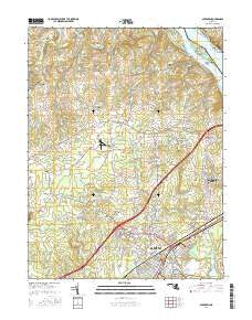
~ Aberdeen MD topo map, 1:24000 scale, 7.5 X 7.5 Minute, 2016
Aberdeen, Maryland, USGS topographic map dated 2016.
Includes geographic coordinates (latitude and longitude). This topographic map is suitable for hiking, camping, and exploring, or framing it as a wall map.
Printed on-demand using high resolution imagery, on heavy weight and acid free paper, or alternatively on a variety of synthetic materials.
Topos available on paper, Waterproof, Poly, or Tyvek. Usually shipping rolled, unless combined with other folded maps in one order.
- Product Number: USGS-8557539
- Free digital map download (high-resolution, GeoPDF): Aberdeen, Maryland (file size: 26 MB)
- Map Size: please refer to the dimensions of the GeoPDF map above
- Weight (paper map): ca. 55 grams
- Map Type: POD USGS Topographic Map
- Map Series: US Topo
- Map Verison: Current
- Cell ID: 50
- Datum: North American Datum of 1983
- Map Projection: Transverse Mercator
- Map Cell Name: Aberdeen
- Grid size: 7.5 X 7.5 Minute
- Date on map: 2016
- Map Scale: 1:24000
- Geographical region: Maryland, United States
Neighboring Maps:
All neighboring USGS topo maps are available for sale online at a variety of scales.
Spatial coverage:
Topo map Aberdeen, Maryland, covers the geographical area associated the following places:
- Locust Hill Estates - Warwick - Paradise Manor - Holly Haven - Woodbrook - Level Terrace - Aldino - Happy Knoll - Burkley Manor - Oakwood - Burns Corner - Swan Creek - Hill Land - Webster - Fair Hill - Hopewell Village - Ramsgate Estates - Green Valley - Emerson Heights - Braemar - Swan Meadows - Hillcrest Manor - Dol Ray - Glenn Heights - Foxridge - Aberdeen Hills - Bar Kess Heights - Silver Acres - Montreal Acres - Oakington Manor - Skyview Estates - Webster Village - Stafford (historical) - Orchardview Estates - Spring Valley Mobile Home Park - Wilson Mill - Carsins Run Estates - Churchville - Nobles Mill Estates - Aberdeen - Hamilton Court - B and J Trailer Park - Swan Harbour Dell Mobile Home Park - Lapidum - Maxa Woods - Susquehanna River Hills - Carsins - North Deen - Carsins Run - Alton Homes - Heritage Estates - Carsinwood - Bodt Corner - Meadowbrook - Earlton - Chesapeake Acres - Level - Lapidum Heights - Hillside - Glenville - Chapel Hills - Sherwood Homes - Stoney Forest Estates - Locksley Manor - Rolling Green - Foxridge West - Rock Run - Moxley - Four Star Mobile Home Park - Park Ridge Estates - Carsin Vale - Crestview - Baldwin Manor - Kirkwood Manor - Adams Heights - Garland - Windemere Estates - Royal Acres - Glenora - Woodside - Quaker Hills - Robin Hood Manor - North Hills - Springhill - Deer Creek Estates - Krouseland - Paradise Heights - Loch Leven - Noble Mill - Mullins Trailer Park
- Map Area ID: AREA39.62539.5-76.25-76.125
- Northwest corner Lat/Long code: USGSNW39.625-76.25
- Northeast corner Lat/Long code: USGSNE39.625-76.125
- Southwest corner Lat/Long code: USGSSW39.5-76.25
- Southeast corner Lat/Long code: USGSSE39.5-76.125
- Northern map edge Latitude: 39.625
- Southern map edge Latitude: 39.5
- Western map edge Longitude: -76.25
- Eastern map edge Longitude: -76.125


