
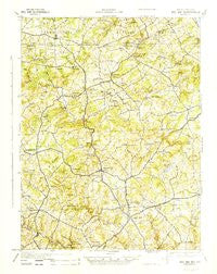
~ Bel Air MD topo map, 1:62500 scale, 15 X 15 Minute, Historical, 1945
Bel Air, Maryland, USGS topographic map dated 1945.
Includes geographic coordinates (latitude and longitude). This topographic map is suitable for hiking, camping, and exploring, or framing it as a wall map.
Printed on-demand using high resolution imagery, on heavy weight and acid free paper, or alternatively on a variety of synthetic materials.
Topos available on paper, Waterproof, Poly, or Tyvek. Usually shipping rolled, unless combined with other folded maps in one order.
- Product Number: USGS-5930245
- Free digital map download (high-resolution, GeoPDF): Bel Air, Maryland (file size: 8 MB)
- Map Size: please refer to the dimensions of the GeoPDF map above
- Weight (paper map): ca. 55 grams
- Map Type: POD USGS Topographic Map
- Map Series: HTMC
- Map Verison: Historical
- Cell ID: 51118
- Scan ID: 461366
- Woodland Tint: Yes
- Aerial Photo Year: 1940
- Datum: NAD27
- Map Projection: Polyconic
- Map published by United States Army Corps of Engineers
- Map published by United States Army
- Map published by United States Department of War
- Map Language: English
- Scanner Resolution: 600 dpi
- Map Cell Name: Belair
- Grid size: 15 X 15 Minute
- Date on map: 1945
- Map Scale: 1:62500
- Geographical region: Maryland, United States
Neighboring Maps:
All neighboring USGS topo maps are available for sale online at a variety of scales.
Spatial coverage:
Topo map Bel Air, Maryland, covers the geographical area associated the following places:
- Laurel Brook - Powder Mill Addition - Bynum - Clear Spring Estates - Howard Park - Allendale Estates - Minefield - Hoerr - Gunpowder Farms - Upper Crest Estates - Campus Valley Estates - Stonehedge - Glenwood - Franklins Chance - Wakefield Meadows - Winters Run - Gibson Manor - Sherrill Gardens - Green Valley - Greenfields - Forest Lake - Village Manor - Baldwin Mill Terrace - Country Village - Fallsmont - Majors Choice - Harold Heights - Brentwood Park - Eagle View - Hickory Village Mobile Home Park - Tollgate Estates - Dunsen Heights - Fairmont - Gibson - Hunting Ridge - North Bel Air - Forest Hill - Leew Woods - Wakely Terrace - Greendale Estates - Rockdale Manor - Springdale - Ridgecroft - Bel Air - Heritage Woods - Oak Ridge - Hazelwood - Belle Farm Heritage - Allibone (historical) - Pinehurst - Long Green Manor - Highview Estates - Hill-N-Dale - Hy-Crest - Green Road Manor - Delta - The Pond - Cherrywood Estates - Bramblewood - Shawnee - Parkwood - Saint Anne - Jarrettsville - Coopstown - Sharon Hill - Midsummer Hill - Tall Oak Manor - Eden Hills - Mill Green - Evergreen Heights - Spring Hill Farms - Hickory Hills - Homestead Village - McDermott - Rush Manor - Southampton - Worthington Heights - Charles Manor - Camelot - Cambria - Timberlea - Greenbrier Hills - Wilsons Choice - Martindale - Valewood Estates - Poplar Grove - Grose Close - Vale - Old Dixie Manor - Oakmont - Deer Park - Quail Hills - Deerfield - Mill Stone Estates - Brook Hill Farms - Carroll Meadows - Cedarwood - Harford Dale - Moxley Acres - Jarrettswood
- Map Area ID: AREA39.7539.5-76.5-76.25
- Northwest corner Lat/Long code: USGSNW39.75-76.5
- Northeast corner Lat/Long code: USGSNE39.75-76.25
- Southwest corner Lat/Long code: USGSSW39.5-76.5
- Southeast corner Lat/Long code: USGSSE39.5-76.25
- Northern map edge Latitude: 39.75
- Southern map edge Latitude: 39.5
- Western map edge Longitude: -76.5
- Eastern map edge Longitude: -76.25


