
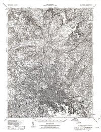
~ Baltimore MD topo map, 1:62500 scale, 15 X 15 Minute, Historical, 1943, updated 1963
Baltimore, Maryland, USGS topographic map dated 1943.
Includes geographic coordinates (latitude and longitude). This topographic map is suitable for hiking, camping, and exploring, or framing it as a wall map.
Printed on-demand using high resolution imagery, on heavy weight and acid free paper, or alternatively on a variety of synthetic materials.
Topos available on paper, Waterproof, Poly, or Tyvek. Usually shipping rolled, unless combined with other folded maps in one order.
- Product Number: USGS-5930237
- Free digital map download (high-resolution, GeoPDF): Baltimore, Maryland (file size: 11 MB)
- Map Size: please refer to the dimensions of the GeoPDF map above
- Weight (paper map): ca. 55 grams
- Map Type: POD USGS Topographic Map
- Map Series: HTMC
- Map Verison: Historical
- Cell ID: 50921
- Scan ID: 461420
- Imprint Year: 1963
- Aerial Photo Year: 1938
- Datum: NAD27
- Map Projection: Polyconic
- Map published by United States Army Corps of Engineers
- Map published by United States Department of War
- Map Language: English
- Scanner Resolution: 600 dpi
- Map Cell Name: Baltimore
- Grid size: 15 X 15 Minute
- Date on map: 1943
- Map Scale: 1:62500
- Geographical region: Maryland, United States
Neighboring Maps:
All neighboring USGS topo maps are available for sale online at a variety of scales.
Spatial coverage:
Topo map Baltimore, Maryland, covers the geographical area associated the following places:
- Stratford - Loch Raven Heights - Haverford - Apple Ridge - Pickwick - Canterbury Estates - Shoresville (historical) - Hampden - Liberty Mobile Home Park - Fellowship Forest - Summerfield Farms - Harford Farms - Woodberry - Dulaney Village - Five Springs West - Oregon - Charles Village - Milford - Pinehurst - Mayfair - West Hills - Pimlico - Shawan Valley - Valewood at Hampton Gardens - Eudowood - Hunt Ridge - Wilhelm Park - Bluegrass Heights - Chapel Hill - Boxer Hill Park - Knollview - Edmondson Village - Glen Ellen - Garden Village Park - Harborview - Leahigh - Kenwood - Carroll Manor - Ridgemont - Ashlar Hill - Lochearn - Butchers Hill - Malvern - Summerfield (historical) - Roland Park - Waverly - Colgate - Summit Chase - Notch Cliff - Cub Hill Farms - Falls Gable - Knettishall - The Cloisters at Charles - Pennbrook - Knoebel - Rosedale Terrace - Kenilworth Park - Long Green - Baronet Woods - Greene Tree - Stevenson - Dun Rovin - The Terraces - Hampton - Catonsville Heights - Euclid Heights - Murray Hill - Seminary Springs - Shetland Hills - Melvale - Halifax Heights - Colonial Village - Westowne - Kenwood - Boxwood - Hunt Cup Hill - Waterspout - Knollcrest Manor - The Village - Parkville - Eastpoint - Coventry - Halcyon Gate - Springhill Farms - Town and Country North - Carney Grove - Mount DeSales - Sherwood - Cromwood - Brooklandville - Eastfield - Walbrook - Caves Park - Manor Springs - Grey Rock - Lakeside - Roslyn Station - Bridleshire - Knollwood - Orchard Hills
- Map Area ID: AREA39.539.25-76.75-76.5
- Northwest corner Lat/Long code: USGSNW39.5-76.75
- Northeast corner Lat/Long code: USGSNE39.5-76.5
- Southwest corner Lat/Long code: USGSSW39.25-76.75
- Southeast corner Lat/Long code: USGSSE39.25-76.5
- Northern map edge Latitude: 39.5
- Southern map edge Latitude: 39.25
- Western map edge Longitude: -76.75
- Eastern map edge Longitude: -76.5


