
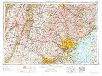
~ Baltimore MD topo map, 1:250000 scale, 1 X 2 Degree, Historical, 1957, updated 1971
Baltimore, Maryland, USGS topographic map dated 1957.
Includes geographic coordinates (latitude and longitude). This topographic map is suitable for hiking, camping, and exploring, or framing it as a wall map.
Printed on-demand using high resolution imagery, on heavy weight and acid free paper, or alternatively on a variety of synthetic materials.
Topos available on paper, Waterproof, Poly, or Tyvek. Usually shipping rolled, unless combined with other folded maps in one order.
- Product Number: USGS-5930235
- Free digital map download (high-resolution, GeoPDF): Baltimore, Maryland (file size: 24 MB)
- Map Size: please refer to the dimensions of the GeoPDF map above
- Weight (paper map): ca. 55 grams
- Map Type: POD USGS Topographic Map
- Map Series: HTMC
- Map Verison: Historical
- Cell ID: 74996
- Scan ID: 461416
- Imprint Year: 1971
- Woodland Tint: Yes
- Aerial Photo Year: 1953
- Edit Year: 1969
- Field Check Year: 1957
- Datum: Unstated
- Map Projection: Transverse Mercator
- Map published by: Military, Other
- Map Language: English
- Scanner Resolution: 600 dpi
- Map Cell Name: Baltimore
- Grid size: 1 X 2 Degree
- Date on map: 1957
- Map Scale: 1:250000
- Geographical region: Maryland, United States
Neighboring Maps:
All neighboring USGS topo maps are available for sale online at a variety of scales.
Spatial coverage:
Topo map Baltimore, Maryland, covers the geographical area associated the following places:
- Glen Hollow - Queen Annes Circle - Gentsville - Indian Hills - Spring Valley Mobile Home Park - Buena Vista Springs - Ashburn Farm - Adams Chance - Colonial Village - Riding Stable Estates - Profit Acres - Holland Hills - Kline Mill - Homewood - Marston - New Valley - Oak Valley - Oliver Beach - Essexshire Gate - Kalmia Ridge - Deakins Range - Blank - Frost - Ricketts Ridge - Wexford - Rosemont - Clearview - White Banks - Piney Hill Estates - Chateau Valley - Ady Estates - Back Swamp - Turf Valley - North Hills - College Station - Longmeadow - Joppa Hills - North Jefferson - Holly Hill - Thistle - Sillery Bay Forest - Mills Farm East - Seven Cedars - Sunset Vista - Riverside - Fairview - Jones - Hernwood - Keysville - Calebs Delight - Rover (historical) - Pleasant View - Runnymeade Estates - Kings Court - Altenwald - Seven Stars - Yorktown - Table Rock - Rocky Acres - Linthicum Heights - Carroll Park - Ridgeleigh - Bel Pre Farms - Burdette - Rockville - Brandenburg Estates - New Freedom - Woodland Beach - Severn - Springbrook Manor - Severn Mills - Kemptown - Highland Acres - Mission Heights - Plyers Mill Estates - Feesersburg - Keeney Mill Woods - Greenvale Village - Hickory Hill - Ridgely Estates - Heritage Farms - Ashton Preserve - Montclare - Indian Princess - Perry Hall Estates - Glenoble - Manor Oaks - Westbury - Howardsville - Malvern - Highland Park - Dar - Oaklyn Manor - Charles Manor - Harristown - Wheatfield Way - Vantage Point - The Oaks at Five Farms - Jarrettswood - Fox Ridge Estates
- Map Area ID: AREA4039-78-76
- Northwest corner Lat/Long code: USGSNW40-78
- Northeast corner Lat/Long code: USGSNE40-76
- Southwest corner Lat/Long code: USGSSW39-78
- Southeast corner Lat/Long code: USGSSE39-76
- Northern map edge Latitude: 40
- Southern map edge Latitude: 39
- Western map edge Longitude: -78
- Eastern map edge Longitude: -76


