
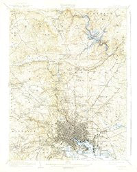
~ Baltimore MD topo map, 1:62500 scale, 15 X 15 Minute, Historical, 1904, updated 1942
Baltimore, Maryland, USGS topographic map dated 1904.
Includes geographic coordinates (latitude and longitude). This topographic map is suitable for hiking, camping, and exploring, or framing it as a wall map.
Printed on-demand using high resolution imagery, on heavy weight and acid free paper, or alternatively on a variety of synthetic materials.
Topos available on paper, Waterproof, Poly, or Tyvek. Usually shipping rolled, unless combined with other folded maps in one order.
- Product Number: USGS-5930227
- Free digital map download (high-resolution, GeoPDF): Baltimore, Maryland (file size: 8 MB)
- Map Size: please refer to the dimensions of the GeoPDF map above
- Weight (paper map): ca. 55 grams
- Map Type: POD USGS Topographic Map
- Map Series: HTMC
- Map Verison: Historical
- Cell ID: 50921
- Scan ID: 461350
- Imprint Year: 1942
- Survey Year: 1902
- Datum: Unstated
- Map Projection: Polyconic
- Map published by United States Geological Survey
- Map Language: English
- Scanner Resolution: 600 dpi
- Map Cell Name: Baltimore
- Grid size: 15 X 15 Minute
- Date on map: 1904
- Map Scale: 1:62500
- Geographical region: Maryland, United States
Neighboring Maps:
All neighboring USGS topo maps are available for sale online at a variety of scales.
Spatial coverage:
Topo map Baltimore, Maryland, covers the geographical area associated the following places:
- Manor Woods - Towson - Ruxton Hills - Milford - Wellington Valley - Helmsley Court - Lowell Ridge - Gwynn Oak - Westwind - Woodberry - Glenmont - Glenside Park - Bridlewood - Notch Cliff - Valley Crest - Hillside at Seminary - Norwood Heights - Arbutus - Daybreak Estates - Homestead - Holly Knoll Estates - Eccleston Valley - Holabird Homes (historical) - Joppa Manor - Padonia - Van Dyke Manor - Manor View - Belmar - Woodmoor - Worthington Ridge - Carroll - Roslyn Station - Dundalk - York Ridge - Knettishall - Patapsco Woods - Walbrook - Weyburn Park - Fulton - Clarence Perkins Homes - Pennbrook - Mayfair - Hudson Heights - Woodward - Waltherson - Harborview - Greenwood - Hunters Hill - Fullerton Heights - Bellview - Donnybrook - Yorkleigh - Mount Royal - Linhigh - Loch Raven - Twinridge - Brookwood - Haverford - Melvale - Woodbrook - Summit Chase - Hunt Ridge - Holland Hills - Broadway-Orleans Homes - Valley Brook - Devonshire Forest - Rutherford Green - Pine Ridge - Windemere - Thornleigh - Hollins (historical) - Apple Ridge - Hillendale - Ridge Grove - Northampton - Featherbed - Dickeyville - Hillsdale Green - Briarwood Farms - Violetville - West Arlington - Highlandtown - Timonium Heights - Harford Hills - Mount Winans - West Baltimore - Kenwood Park - Cheswolde - Franklintown - The Oaks at Five Farms - Idlewood - Lauraville - Broadmoor - Parkville - Rodgers Forge - Chapel Hill - Edmondson Village - Mount Vernon - Bluegrass Heights - Mount Hope
- Map Area ID: AREA39.539.25-76.75-76.5
- Northwest corner Lat/Long code: USGSNW39.5-76.75
- Northeast corner Lat/Long code: USGSNE39.5-76.5
- Southwest corner Lat/Long code: USGSSW39.25-76.75
- Southeast corner Lat/Long code: USGSSE39.25-76.5
- Northern map edge Latitude: 39.5
- Southern map edge Latitude: 39.25
- Western map edge Longitude: -76.75
- Eastern map edge Longitude: -76.5


