
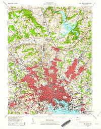
~ Baltimore MD topo map, 1:62500 scale, 15 X 15 Minute, Historical, 1943, updated 1963
Baltimore, Maryland, USGS topographic map dated 1943.
Includes geographic coordinates (latitude and longitude). This topographic map is suitable for hiking, camping, and exploring, or framing it as a wall map.
Printed on-demand using high resolution imagery, on heavy weight and acid free paper, or alternatively on a variety of synthetic materials.
Topos available on paper, Waterproof, Poly, or Tyvek. Usually shipping rolled, unless combined with other folded maps in one order.
- Product Number: USGS-5930223
- Free digital map download (high-resolution, GeoPDF): Baltimore, Maryland (file size: 10 MB)
- Map Size: please refer to the dimensions of the GeoPDF map above
- Weight (paper map): ca. 55 grams
- Map Type: POD USGS Topographic Map
- Map Series: HTMC
- Map Verison: Historical
- Cell ID: 50921
- Scan ID: 461347
- Imprint Year: 1963
- Woodland Tint: Yes
- Aerial Photo Year: 1938
- Datum: NAD27
- Map Projection: Polyconic
- Map published by United States Geological Survey
- Map published by United States Army Corps of Engineers
- Map published by United States Army
- Map published by United States Department of War
- Map Language: English
- Scanner Resolution: 600 dpi
- Map Cell Name: Baltimore
- Grid size: 15 X 15 Minute
- Date on map: 1943
- Map Scale: 1:62500
- Geographical region: Maryland, United States
Neighboring Maps:
All neighboring USGS topo maps are available for sale online at a variety of scales.
Spatial coverage:
Topo map Baltimore, Maryland, covers the geographical area associated the following places:
- Colgate - Haywood Heights - Hillbrook - Keyser Woods - Greenwood - Parkville Heights - Melvale - Fellowship Forest - Ruxton Hills - Cub Hills - Cronhardt - Velvet Valley - Catonsville Manor - Eden Roc - Parkside Heights - Dundalk - Chapel Ridge - Rockland Run - Halcyon Gate - Ravenhurst - Valewood at Hampton Gardens - Harford Farms - Leahigh - Garden Village Park - Colonial Village - Eastpoint - Willow Glen - Homestead - Meadowcliff - Autumn Wind - Overlea - Pickwick - Williamsburg - Greene Tree - Pikesville - Lauraville - Waterspout - Dun Rovin - Sturbridge - Canterbury Estates - Bellview - Hickory Meadow - Windsor Mill Manor - Mayfair - The Falls - Providence - The Willows of Ruxton - Twinridge - Charlestown - Morrisville - Walbrook - Holland Hills - Bridlewood - Windsor Hills - Wakefield - Norwood Park - Hunters Hill - Lowell Ridge - Long Meadow West - Cub Hill - Pine Ridge - Loch Raven Village - Wilhelm Park - West Forest Park - Denmore Park - Roland Park - Dulaney Gate - Harford Park - Knollview - Woodbrook - Orchard Hills - Hampton Village - Burnbrae - Ridervale - Hillstead - Manor View - Chapelgate - Roslyn - Timonium - Hillside Hunt - Highlandtown - The Pines at Deep Run - The Oaks at Five Farms - Windsor Terrace - Harrington Manor - Wetheredsville - Woodward - Sorrento - Irvington - Hampden - Armistead Gardens - Hudson Heights - Brookview Farms - Parktowne - Clarence Perkins Homes - Shoresville (historical) - Notch Cliff - Dogwood Hills - Northwind Village - Martins Choice
- Map Area ID: AREA39.539.25-76.75-76.5
- Northwest corner Lat/Long code: USGSNW39.5-76.75
- Northeast corner Lat/Long code: USGSNE39.5-76.5
- Southwest corner Lat/Long code: USGSSW39.25-76.75
- Southeast corner Lat/Long code: USGSSE39.25-76.5
- Northern map edge Latitude: 39.5
- Southern map edge Latitude: 39.25
- Western map edge Longitude: -76.75
- Eastern map edge Longitude: -76.5


