
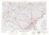
~ Baltimore MD topo map, 1:250000 scale, 1 X 2 Degree, Historical, 1957, updated 1964
Baltimore, Maryland, USGS topographic map dated 1957.
Includes geographic coordinates (latitude and longitude). This topographic map is suitable for hiking, camping, and exploring, or framing it as a wall map.
Printed on-demand using high resolution imagery, on heavy weight and acid free paper, or alternatively on a variety of synthetic materials.
Topos available on paper, Waterproof, Poly, or Tyvek. Usually shipping rolled, unless combined with other folded maps in one order.
- Product Number: USGS-5930221
- Free digital map download (high-resolution, GeoPDF): Baltimore, Maryland (file size: 18 MB)
- Map Size: please refer to the dimensions of the GeoPDF map above
- Weight (paper map): ca. 55 grams
- Map Type: POD USGS Topographic Map
- Map Series: HTMC
- Map Verison: Historical
- Cell ID: 74996
- Scan ID: 461346
- Imprint Year: 1964
- Edit Year: 1963
- Field Check Year: 1957
- Datum: Unstated
- Map Projection: Transverse Mercator
- Map published by United States Geological Survey
- Map published by United States Army Corps of Engineers
- Map published by United States Army
- Map Language: English
- Scanner Resolution: 600 dpi
- Map Cell Name: Baltimore
- Grid size: 1 X 2 Degree
- Date on map: 1957
- Map Scale: 1:250000
- Geographical region: Maryland, United States
Neighboring Maps:
All neighboring USGS topo maps are available for sale online at a variety of scales.
Spatial coverage:
Topo map Baltimore, Maryland, covers the geographical area associated the following places:
- Valley Heights - Travilah Meadows - Parson Hill - Mount Airy Village West - Furnace Mountain - Oak Lea - Yorkana - Holiday Acres - Worton Heights - Cowell - Friendship Heights - Chartley - Allview Estates - Sharrer Heights - Middlebrook - Nova - Betterton - Shamrock Acres - Mort Hills - Grange - Severn - Larchmont Knolls - Putty Hill - Perry Hall Estates - Greenspring Hill - Woodland Way - Southview - Scattersville - New Estates - Countryside - Mounts Scenic Acres - Martins Crossroads - Shamburg (historical) - Timbermead - Sandy Hill Acres - Coventry Meadows - Bear Run - Rolphs - Towson - Smiths Station - Bobs Flow - Walden Farms - Harristown - Lockport - Brooke Meadow - Sweetser Heights - Delight - The Chase - North Wind - Foster Branch - Florence Farms - Walnut Hill - Dreams Landing - Holiday Mobile Home Estates - Bessemer - Kilmarnock - Box Hill South - Gibralter Acres - Brightwood - Worthington Club Estates - Keeney Mill Farms - Jessie Anne Estates - Roundtree - Canbury Woods - Holler - Bel Pre Farms - Shirleyville - Beantown - Stevenson Park - Mountain - Cross Roads - Deep Run - Montgomery Knolls - Monrovia - Cameron Tract - Mill Green - Mountain View Estates - Harewood - Fairoaks - Freeland - Harvest Hills - Eccleston - Broadway-Orleans Homes - Harford Commons - Mount Olivet Heights - Sylvan View - Shucks Corners - Kempfield - Honey Hill - Whiteford - Redland - Crestleigh - Adams Heights - Dickey - Malvern - Spring Ridge - Catoctin Highlands - Brightview Woods - Lewistown - Ritz Estates
- Map Area ID: AREA4039-78-76
- Northwest corner Lat/Long code: USGSNW40-78
- Northeast corner Lat/Long code: USGSNE40-76
- Southwest corner Lat/Long code: USGSSW39-78
- Southeast corner Lat/Long code: USGSSE39-76
- Northern map edge Latitude: 40
- Southern map edge Latitude: 39
- Western map edge Longitude: -78
- Eastern map edge Longitude: -76


