
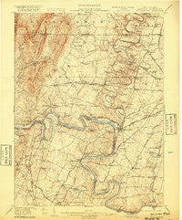
~ Williamsport MD topo map, 1:62500 scale, 15 X 15 Minute, Historical, 1912, updated 1920
Williamsport, Maryland, USGS topographic map dated 1912.
Includes geographic coordinates (latitude and longitude). This topographic map is suitable for hiking, camping, and exploring, or framing it as a wall map.
Printed on-demand using high resolution imagery, on heavy weight and acid free paper, or alternatively on a variety of synthetic materials.
Topos available on paper, Waterproof, Poly, or Tyvek. Usually shipping rolled, unless combined with other folded maps in one order.
- Product Number: USGS-5660088
- Free digital map download (high-resolution, GeoPDF): Williamsport, Maryland (file size: 10 MB)
- Map Size: please refer to the dimensions of the GeoPDF map above
- Weight (paper map): ca. 55 grams
- Map Type: POD USGS Topographic Map
- Map Series: HTMC
- Map Verison: Historical
- Cell ID: 64561
- Scan ID: 253935
- Imprint Year: 1920
- Survey Year: 1910
- Datum: Unstated
- Map Projection: Unstated
- Map published by United States Geological Survey
- Keywords: Overedge
- Map Language: English
- Scanner Resolution: 600 dpi
- Map Cell Name: Williamsport
- Grid size: 15 X 15 Minute
- Date on map: 1912
- Map Scale: 1:62500
- Geographical region: Maryland, United States
Neighboring Maps:
All neighboring USGS topo maps are available for sale online at a variety of scales.
Spatial coverage:
Topo map Williamsport, Maryland, covers the geographical area associated the following places:
- Worleytown - Fairview - Downsville - Berkeley - Big Spring - Bedington - Martins Crossroads - Cloverton - Woodmoor - Arboranda Estates - Cearfoss - Nipetown - Hainesville - Greenberry Hills - Pinesburg - Van Lear Manor - Oaklett Estates - Lake Fairplay Estates - Hedgesville - Forsythe - Green Spring Furnace - Potomac Woodlands - Mason and Dixon - Clear Spring - Kent Estates - Bakersville - Fairview Acres - Nova - Deer Lodge Mobile Home Park - Tammany Manor - Dogtown - Rockdale - Opequon Farms - Spickler - Marlowe - Bessemer - Spring Mills - Fairplay Farms - Saint James - Ashton - Huyett - Conococheague - Georgetown - Kemps - Halfway Manor - Little Georgetown - Greenspring Hill - Cedar Grove - Charlton - Spielman - Gardenspot - Washington Four - Troupe Springs - Allensville - Grimes - Halfway - Fairview Mill - Falling Waters - Gristmill Hill - Williamsport - Conococheaque - Kasiesville - Four Locks - Sylvan Grove - Friendship Park - Cedar Lawn - Woburn Estates - Dry Run - Bostetter - Mount Moriah - Pleasant View Estates - Woodburn on the Potomac - Coseytown - Spring Hill Estates - Broadfording - Tabb (historical) - Wilson - North Mountain - Heritage Estates - Two Locks - Oak Ridge - Shady Bower
- Map Area ID: AREA39.7539.5-78-77.75
- Northwest corner Lat/Long code: USGSNW39.75-78
- Northeast corner Lat/Long code: USGSNE39.75-77.75
- Southwest corner Lat/Long code: USGSSW39.5-78
- Southeast corner Lat/Long code: USGSSE39.5-77.75
- Northern map edge Latitude: 39.75
- Southern map edge Latitude: 39.5
- Western map edge Longitude: -78
- Eastern map edge Longitude: -77.75


