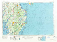
~ Salisbury MD topo map, 1:250000 scale, 1 X 2 Degree, Historical, 1946, updated 1971
Salisbury, Maryland, USGS topographic map dated 1946.
Includes geographic coordinates (latitude and longitude). This topographic map is suitable for hiking, camping, and exploring, or framing it as a wall map.
Printed on-demand using high resolution imagery, on heavy weight and acid free paper, or alternatively on a variety of synthetic materials.
Topos available on paper, Waterproof, Poly, or Tyvek. Usually shipping rolled, unless combined with other folded maps in one order.
- Product Number: USGS-5368758
- Free digital map download (high-resolution, GeoPDF): Salisbury, Maryland (file size: 21 MB)
- Map Size: please refer to the dimensions of the GeoPDF map above
- Weight (paper map): ca. 55 grams
- Map Type: POD USGS Topographic Map
- Map Series: HTMC
- Map Verison: Historical
- Cell ID: 74990
- Scan ID: 257782
- Imprint Year: 1971
- Woodland Tint: Yes
- Edit Year: 1969
- Datum: Unstated
- Map Projection: Transverse Mercator
- Map published by United States Geological Survey
- Map Language: English
- Scanner Resolution: 600 dpi
- Map Cell Name: Salisbury
- Grid size: 1 X 2 Degree
- Date on map: 1946
- Map Scale: 1:250000
- Geographical region: Maryland, United States
Neighboring Maps:
All neighboring USGS topo maps are available for sale online at a variety of scales.
Spatial coverage:
Topo map Salisbury, Maryland, covers the geographical area associated the following places:
- Ironshire - Banksville Park - Sea Colony - Sussex Woods - Shady Acres Mobile Home Park - Hickory Acres - Walston - Woods Edge - McDonalds Crossroads - Georgetown - North Shores - Quakers Heights - Monie - Gum Swamp - Frenchtown - Cottage Grove - Columbia - Country Living Mobile Home Park - Ocean Village - Pittsville Manor - Greens Corner - County Seat Gardens Mobile Home Park - West Bay Park Mobile Home Park - Keenwik West - Denton Woods Mobile Home Park - Parsonsburg - Newark - Green Hill - Dogwood Acres Mobile Home Park - Conners Corner - D and K Mobile Home Park - Pine Grove - Carey Acres - Avalon Park - Red Mill Farms - Middlesex Beach - Piney Grove Estates - Omar - Public Landing - The Glade - Overbrook Manor - Greenwood - Matyiko Manor - Sandy Point - Gran-ville - Bivalve - Goslee Mill - Rum Ridge Estates - Harlemtown - Essex Ridge - Hynson - Lakeside Manor - Tru Vale Acres - Springfield Farms Addition - Long Neck - Shaffer Property - Greenville - Friendship Estates - Murray Estates - Bishopville - The Plantations - Arabian Acres - Nassau - Holiday Estates - Holiday Manor - Colonial Acres - Denton Mills - Waples Pond Acres - Knowles Crossroads - Hollybrook Apartments - Wildwoods - Tessie-Maringola Estates - Woods Edge - Concord Heights - Shawnee - Banks Acres - Reeves Crossing - Drawbridge - Bryans Store - Whitesville - Nentego Manor - Hill N Dale - Hurlock - Hopkins Corners - Cannon Farm - Franklin City - Providence - Cedar Hurst Village - Arbre Park Mobile Home Park - Hazzard Landing - Green Acres - Dublin Hill - Rabbit Town - Oriole - Tanyard Estates - Waddells Corner - Mount Olive Manor - Parkview - Golf Club Shores - Pine Water Farm
- Map Area ID: AREA3938-76-74
- Northwest corner Lat/Long code: USGSNW39-76
- Northeast corner Lat/Long code: USGSNE39-74
- Southwest corner Lat/Long code: USGSSW38-76
- Southeast corner Lat/Long code: USGSSE38-74
- Northern map edge Latitude: 39
- Southern map edge Latitude: 38
- Western map edge Longitude: -76
- Eastern map edge Longitude: -74


