
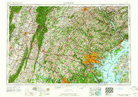
~ Baltimore MD topo map, 1:250000 scale, 1 X 2 Degree, Historical, 1961
Baltimore, Maryland, USGS topographic map dated 1961.
Includes geographic coordinates (latitude and longitude). This topographic map is suitable for hiking, camping, and exploring, or framing it as a wall map.
Printed on-demand using high resolution imagery, on heavy weight and acid free paper, or alternatively on a variety of synthetic materials.
Topos available on paper, Waterproof, Poly, or Tyvek. Usually shipping rolled, unless combined with other folded maps in one order.
- Product Number: USGS-5368730
- Free digital map download (high-resolution, GeoPDF): Baltimore, Maryland (file size: 28 MB)
- Map Size: please refer to the dimensions of the GeoPDF map above
- Weight (paper map): ca. 55 grams
- Map Type: POD USGS Topographic Map
- Map Series: HTMC
- Map Verison: Historical
- Cell ID: 74996
- Scan ID: 257766
- Woodland Tint: Yes
- Field Check Year: 1957
- Datum: Unstated
- Map Projection: Transverse Mercator
- Map published by United States Geological Survey
- Map Language: English
- Scanner Resolution: 600 dpi
- Map Cell Name: Baltimore
- Grid size: 1 X 2 Degree
- Date on map: 1961
- Map Scale: 1:250000
- Geographical region: Maryland, United States
Neighboring Maps:
All neighboring USGS topo maps are available for sale online at a variety of scales.
Spatial coverage:
Topo map Baltimore, Maryland, covers the geographical area associated the following places:
- Burnt Mills Hills - Rouzerville - Flickerwood - Ivandale - Sharon Oaks - Valleybrook - Knoxlyn - Meredith Homes - Hawlings View - Clifton - Rockville - Bridgeport - Smithville - Hanford Estates - Water View - Frederick Heights - Mountaindale - Midway - Watson Place - Countryside - Edgewood - Shrys Store - Brooks Hill - Sable Woods - Long Meadows Estates - Slidell - Evergreen Hills - Shookstown - Stone Hill - Shenandoah Junction - Friends View - Eastland Hills - Happy Knoll - Valewood at Hampton Gardens - Pine Crest West - Calmes Neck Estates - Waterford Place - Walkers Choice - Kyleville - Vale Hills - Larchmont Knolls - Harford Estates - Arlington - Hamilton Court - Wolf Hill - Prospect Heights - Sycamore Heights - Hilltop Woods - Riverdale Forest - Corridor North - Brodbecks - Richardsmere - Susquehanna Hills - Fairfield Homes - Point Pleasant - Willow - Fairview Estates - Fox Meadows Woods - Cranberry - Walden Farms - Brooklyn - Charolais Acres - Hahns Mill - Rockaway Beach - White Hall - Wildwood Beach - Brookview Farms - Sugarloaf Vista - Hemlock Hill - Halifax Heights - Holtwood - Arundel Hills - Ashcroft - Driver - Harford Village - Pleasant Hills - Carroll Park - Norwood Knolls - Hunt Valley - Glenshire Towne - Kings Court - Charlesmont - Wolfs Mill - Fairland Acres - Milltown - Benson - Correlli Estates - Dulaney Valley (historical) - Fox Rest - Pipe Creek Mill - Woods Edge - Liberty Mobile Home Park - Peach Orchard Heights - Silver Acres - Mount Pleasant (historical) - Rebecca Ridge - Hunter Green - Ijamsville - Old Severna Park - Scotts Level
- Map Area ID: AREA4039-78-76
- Northwest corner Lat/Long code: USGSNW40-78
- Northeast corner Lat/Long code: USGSNE40-76
- Southwest corner Lat/Long code: USGSSW39-78
- Southeast corner Lat/Long code: USGSSE39-76
- Northern map edge Latitude: 40
- Southern map edge Latitude: 39
- Western map edge Longitude: -78
- Eastern map edge Longitude: -76


