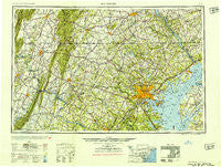
~ Baltimore MD topo map, 1:250000 scale, 1 X 2 Degree, Historical, 1954
Baltimore, Maryland, USGS topographic map dated 1954.
Includes geographic coordinates (latitude and longitude). This topographic map is suitable for hiking, camping, and exploring, or framing it as a wall map.
Printed on-demand using high resolution imagery, on heavy weight and acid free paper, or alternatively on a variety of synthetic materials.
Topos available on paper, Waterproof, Poly, or Tyvek. Usually shipping rolled, unless combined with other folded maps in one order.
- Product Number: USGS-5368726
- Free digital map download (high-resolution, GeoPDF): Baltimore, Maryland (file size: 22 MB)
- Map Size: please refer to the dimensions of the GeoPDF map above
- Weight (paper map): ca. 55 grams
- Map Type: POD USGS Topographic Map
- Map Series: HTMC
- Map Verison: Historical
- Cell ID: 74996
- Scan ID: 257764
- Woodland Tint: Yes
- Aerial Photo Year: 1944
- Datum: NAD27
- Map Projection: Transverse Mercator
- Map published by United States Army Corps of Engineers
- Map published by United States Army
- Map Language: English
- Scanner Resolution: 600 dpi
- Map Cell Name: Baltimore
- Grid size: 1 X 2 Degree
- Date on map: 1954
- Map Scale: 1:250000
- Geographical region: Maryland, United States
Neighboring Maps:
All neighboring USGS topo maps are available for sale online at a variety of scales.
Spatial coverage:
Topo map Baltimore, Maryland, covers the geographical area associated the following places:
- Stone Hill - Colemanville - Nightingale - Catoctin Manor Estates - Aspen Knolls - Odenton - Fountain Green - Singer Heights - Twin Brook Estates - Greenbrier - Tufton Ridge Estates - Stewart Town - Crabster (historical) - Keysville - Islands of Balmoral - Edgewood - South Kensington - Broadmoor - Bardane - Woodbine - Aspen Run - Indian Landing Estates - Stoney View - Robindale - Stoverstown - Longview - Phelps - Cohansey Village - Bellvale - Rockcrest - Birchwood - Araby View - Canterbury Estates - Williamsburg Estates - Biscayne Bay Village - Deerfield - Dunkeld Manor - Country Ridge - Liberty Manor - Oakleigh - Hawbottom Heights - Woodbridge - Academy Junction - Rippon - Pine Haven - Ashburn Junction - Greenwood - Crestview - Villa Green - Drexel Estates - Wentz - Severn Mobile Home Park - Harmony Hills - Centerville - My Ladies Manor - Silver Acres - McKenney Hills - Bells Mobile Home Park - Columbia - Chesney - Arthur Ridge - Elmwood - North Point Village - Maple View - Broadwood Manor - Belleview Estates - Rinely - Smugglers Cove - Capri Estates - Cloverdale - Parkside - Olacin - Airport Acres - Ravenwood Estates - Chase Wood Run - Penn Grove - Putnam - Blue Mountain - Gray Rock - Stockton Green - Merrywood - Five Forks Estates - Indian Hills - New Design Acres - Conowingo Village - Zentmyer - Jennings Chapel Woods - Middleburg - Stonewood Farms - Puseyville - Carrs Mill - Bar-Klee Estates - Ballenger Heights - Ashcroft - Egypt - Catoctin Park - Kiah Estates - Kinfield Estates - Armistead Gardens - Shady Bower
- Map Area ID: AREA4039-78-76
- Northwest corner Lat/Long code: USGSNW40-78
- Northeast corner Lat/Long code: USGSNE40-76
- Southwest corner Lat/Long code: USGSSW39-78
- Southeast corner Lat/Long code: USGSSE39-76
- Northern map edge Latitude: 40
- Southern map edge Latitude: 39
- Western map edge Longitude: -78
- Eastern map edge Longitude: -76


