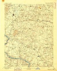
~ Frederick MD topo map, 1:125000 scale, 30 X 30 Minute, Historical, 1894
Frederick, Maryland, USGS topographic map dated 1894.
Includes geographic coordinates (latitude and longitude). This topographic map is suitable for hiking, camping, and exploring, or framing it as a wall map.
Printed on-demand using high resolution imagery, on heavy weight and acid free paper, or alternatively on a variety of synthetic materials.
Topos available on paper, Waterproof, Poly, or Tyvek. Usually shipping rolled, unless combined with other folded maps in one order.
- Product Number: USGS-5368656
- Free digital map download (high-resolution, GeoPDF): Frederick, Maryland (file size: 8 MB)
- Map Size: please refer to the dimensions of the GeoPDF map above
- Weight (paper map): ca. 55 grams
- Map Type: POD USGS Topographic Map
- Map Series: HTMC
- Map Verison: Historical
- Cell ID: 65519
- Scan ID: 257725
- Survey Year: 1889
- Datum: Unstated
- Map Projection: Unstated
- Map published by United States Geological Survey
- Map Language: English
- Scanner Resolution: 600 dpi
- Map Cell Name: Frederick
- Grid size: 30 X 30 Minute
- Date on map: 1894
- Map Scale: 1:125000
- Geographical region: Maryland, United States
Neighboring Maps:
All neighboring USGS topo maps are available for sale online at a variety of scales.
Spatial coverage:
Topo map Frederick, Maryland, covers the geographical area associated the following places:
- Wooded Acres - Robin Meadows - Urbana - Parkwood - Florence Manor - Lake Potomac - Sherwood Forest - Chestnut Oaks - Whetstone - Metropolitan Grove - Colesville Park - Hanford Estates - Water View - Ridgewood Estates - Pioneer Hills - Harmony Grove - Glen Cameron Estates - Sterling - Tuscarora Knolls - Woodside Park - Glenora Hills - McAuley Park - Glade Town - Sundays Manor - Tuscarora - Meadowcrest - Brookmead - Silver Fern Estates - Edgewood - Ancient Oak - Wheaton - Ballenger Heights - Luxmanor - White Flint Springs - Burnt Mills Village - River Plantations - Norwood Knolls - Burnt Mills Manor - Round Hill - Montgomery Square - Bloom - Falls Orchard - Woodley Gardens - Taskers Chance - Alta Vista Terrace - Ridgely Estates - Olde Oak Run - Washingtonian Woods - Mountain View - Tolley Terrace - Fox Ridge Estates - Ballenger Creek Meadows - Lawrence - Hillside Estates - Manor Village - Farmingdale Estates - North Bethesda - Potomac Chase Estates - Monocacy Village - Quince Orchard Knolls - Rollins Park - Walnut Woods - Darby-Lux - Chases Forest - Ijamsville - Whittier - Kensington Estates - Countryside - New Venture Estates - Sunshine Acres - Cashell Manor - Fair Wind Estates - Woodridge - Walkersville - Spring Lake Park - Fremont Hills - Quail Creek Acres - Carolina Hills - Norbrook Village - Latigo Trails - White Rock - Park Mills - Bondbrook - Twin Brook Forest - Hemp Hills - Foxlair Acres - Potomac Manors - Olney Mill - East Rolling Hills - Silver Hill - Dulles Town Center - Sunny Acres - Frenchton Place - Rock Creek Village - Parrsville - Sandy Spring - North Potomac - Oak Acres - Old Germantown - Quince Orchard Manor
- Map Area ID: AREA39.539-77.5-77
- Northwest corner Lat/Long code: USGSNW39.5-77.5
- Northeast corner Lat/Long code: USGSNE39.5-77
- Southwest corner Lat/Long code: USGSSW39-77.5
- Southeast corner Lat/Long code: USGSSE39-77
- Northern map edge Latitude: 39.5
- Southern map edge Latitude: 39
- Western map edge Longitude: -77.5
- Eastern map edge Longitude: -77


