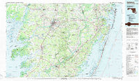
~ Salisbury MD topo map, 1:100000 scale, 30 X 60 Minute, Historical, 1983, updated 1984
Salisbury, Maryland, USGS topographic map dated 1983.
Includes geographic coordinates (latitude and longitude). This topographic map is suitable for hiking, camping, and exploring, or framing it as a wall map.
Printed on-demand using high resolution imagery, on heavy weight and acid free paper, or alternatively on a variety of synthetic materials.
Topos available on paper, Waterproof, Poly, or Tyvek. Usually shipping rolled, unless combined with other folded maps in one order.
- Product Number: USGS-5368638
- Free digital map download (high-resolution, GeoPDF): Salisbury, Maryland (file size: 26 MB)
- Map Size: please refer to the dimensions of the GeoPDF map above
- Weight (paper map): ca. 55 grams
- Map Type: POD USGS Topographic Map
- Map Series: HTMC
- Map Verison: Historical
- Cell ID: 68293
- Scan ID: 257713
- Imprint Year: 1984
- Woodland Tint: Yes
- Aerial Photo Year: 1980
- Edit Year: 1983
- Datum: NAD27
- Map Projection: Universal Transverse Mercator
- Map published by United States Geological Survey
- Map Language: English
- Scanner Resolution: 600 dpi
- Map Cell Name: Salisbury
- Grid size: 30 X 60 Minute
- Date on map: 1983
- Map Scale: 1:100000
- Geographical region: Maryland, United States
Neighboring Maps:
All neighboring USGS topo maps are available for sale online at a variety of scales.
Spatial coverage:
Topo map Salisbury, Maryland, covers the geographical area associated the following places:
- Wellington Estates - Indian Cove - Oakdale Acres - River Isle Estates - Midvale Manor - Brinkley Heights - Rolling Hills - Westlake - Trace Hollow - Melson - Wenona - Bestpitch - Newland Park - Snow Hill - Maple Plains - Harmon Landing Estates - Brookdale Heights - Autumn Grove - Centennial Village - Newark - Bivalve - Kathleens Delight - Belmont - Saint George - Hearts Ease - Milburn Landing - Fenwick Estates - Dills Acres - Butlers Beach - Bayville - Sunset Heights - Tanglewood - Albatross Mobile Home Park - Mulberry Landing - Mount Wesley - Greenwood Place - Salisbury - High Bank Estates - Greenhill - Cedartown - Fruitland - Edwin (historical) - Manklin Meadows - Park Manor - Colbourn Manor - Cape Windsor Mobile Home Park - Hallet Heights - Capitola - Hayden Acres - Avalon Park - Moss Hill Acres - Brookshire Knolls - Brick House Landing - Princess Anne - Upper Ferry Acres - Spence - Nottingham Woods - East Winds - Manokin - Marion - Jersey Road Estates - Cannon Farm - Keen-Wik - Bayside Keys - Welbourne - Ward - Pittsville - Parkhurst Manor - Pomona Heights - Timmonstown - Mount Olive Manor - Lewis Corner - Whitesville - Riverside Homes - Carey Acres - Willow Grove - Seabright - Rustic Acres - Plainfield - Beachwood - Chesapeake Heights - Foggy Bottom - Figgs Landing - Deal Island - Pine Beach - Pine Grove - Brafferton - Rumbley - Puncheon Landing - Coxs Corner - Smithwood Manor - Sierra Manor - Gum Swamp - Cedarhurst Village Trailer Park - Pintail Isle - Stage Mobile Home Village - Hudson Landing - Whittington Park - Mount Vernon - Piney Point
- Map Area ID: AREA38.538-76-75
- Northwest corner Lat/Long code: USGSNW38.5-76
- Northeast corner Lat/Long code: USGSNE38.5-75
- Southwest corner Lat/Long code: USGSSW38-76
- Southeast corner Lat/Long code: USGSSE38-75
- Northern map edge Latitude: 38.5
- Southern map edge Latitude: 38
- Western map edge Longitude: -76
- Eastern map edge Longitude: -75


