
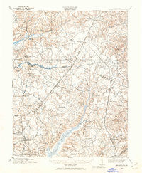
~ Brandywine MD topo map, 1:62500 scale, 15 X 15 Minute, Historical, 1911, updated 1962
Brandywine, Maryland, USGS topographic map dated 1911.
Includes geographic coordinates (latitude and longitude). This topographic map is suitable for hiking, camping, and exploring, or framing it as a wall map.
Printed on-demand using high resolution imagery, on heavy weight and acid free paper, or alternatively on a variety of synthetic materials.
Topos available on paper, Waterproof, Poly, or Tyvek. Usually shipping rolled, unless combined with other folded maps in one order.
- Product Number: USGS-5367994
- Free digital map download (high-resolution, GeoPDF): Brandywine, Maryland (file size: 8 MB)
- Map Size: please refer to the dimensions of the GeoPDF map above
- Weight (paper map): ca. 55 grams
- Map Type: POD USGS Topographic Map
- Map Series: HTMC
- Map Verison: Historical
- Cell ID: 51736
- Scan ID: 257323
- Imprint Year: 1962
- Survey Year: 1911
- Datum: NAD27
- Map Projection: Polyconic
- Map published by United States Geological Survey
- Map Language: English
- Scanner Resolution: 600 dpi
- Map Cell Name: Brandywine
- Grid size: 15 X 15 Minute
- Date on map: 1911
- Map Scale: 1:62500
- Geographical region: Maryland, United States
Neighboring Maps:
All neighboring USGS topo maps are available for sale online at a variety of scales.
Spatial coverage:
Topo map Brandywine, Maryland, covers the geographical area associated the following places:
- Cedarville Mobile Home Park - Mill Hill Estates - Windbrook - Hunt Club Estates - Piscataway Estates - Piscataway - Bannister - White Hall Terrace - Silesia - Morgans Ridge - Jennie Run Estates - Walnut Hills - Belleair Estates - Ashbox - Danville - Old Ford Hills - Huntington Townhouses - Pine Hill Estates - Townshend - Hickory Ridge - La Plata - Sharperville - West White Plains - Clinton Hills - Sandy Level Estates - Hidden Valley - Brooke Jane Manor - Capitol Estates - Springhaven - Green Acres - Pleasant Springs - Holt Manor - Park Estates - White Plains - Lynnbrook - Sun Valley Estates - Lakeside Mews - Karen Knolls - Clinton Acres - Carrico Mill Estates - Hunters Farms - Fox Run - Brandywine - Greenmont - Green Acres Estates - Idlewood Park - Windsor Manor - Gallant Green Woods - Hickory Thicket - West End Farms - Three Brothers - Bryantown Hills - Zekiah Valley - Charles County Gardens - Dorchester - Tippett - Mount Carmel Woods - Halley Estates - Bryantown - Cheltenham Acres - Huntington - Glen Oak - Northwood - Cedar Lawn - Middletown - Roosevelt Heights - North Keys - The Meadows - Kindy Hook - Country Club South - Forest Glen Estates - Holly Station - Kings Grant - Oak Hill Estates - Boniwood - Talbert (historical) - Holly Tree Park - Knolland - Acton Village - Independence Village - Constitution Hills - Gillespie Mobile Home Court - Land Tree - Haldane - Charowood - Marlton South - Delight - Brynwood Farm Estates - Duley - Clayton Run Estates - Brandywine Forest - Mattawoman Estates - Edelen Estates - Idlewood Trailer Park - Waldorf - White Plains Village - Quailwood - Mariellen Park - White Oak Village - Clarks Run
- Map Area ID: AREA38.7538.5-77-76.75
- Northwest corner Lat/Long code: USGSNW38.75-77
- Northeast corner Lat/Long code: USGSNE38.75-76.75
- Southwest corner Lat/Long code: USGSSW38.5-77
- Southeast corner Lat/Long code: USGSSE38.5-76.75
- Northern map edge Latitude: 38.75
- Southern map edge Latitude: 38.5
- Western map edge Longitude: -77
- Eastern map edge Longitude: -76.75


