
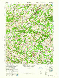
~ Belair MD topo map, 1:62500 scale, 15 X 15 Minute, Historical, 1963
Belair, Maryland, USGS topographic map dated 1963.
Includes geographic coordinates (latitude and longitude). This topographic map is suitable for hiking, camping, and exploring, or framing it as a wall map.
Printed on-demand using high resolution imagery, on heavy weight and acid free paper, or alternatively on a variety of synthetic materials.
Topos available on paper, Waterproof, Poly, or Tyvek. Usually shipping rolled, unless combined with other folded maps in one order.
- Product Number: USGS-5367958
- Free digital map download (high-resolution, GeoPDF): Belair, Maryland (file size: 11 MB)
- Map Size: please refer to the dimensions of the GeoPDF map above
- Weight (paper map): ca. 55 grams
- Map Type: POD USGS Topographic Map
- Map Series: HTMC
- Map Verison: Historical
- Cell ID: 51118
- Scan ID: 257305
- Woodland Tint: Yes
- Aerial Photo Year: 1947
- Field Check Year: 1948
- Datum: NAD27
- Map Projection: Transverse Mercator
- Map published by United States Army Corps of Engineers
- Map published by United States Army
- Map Language: English
- Scanner Resolution: 600 dpi
- Map Cell Name: Belair
- Grid size: 15 X 15 Minute
- Date on map: 1963
- Map Scale: 1:62500
- Geographical region: Maryland, United States
Neighboring Maps:
All neighboring USGS topo maps are available for sale online at a variety of scales.
Spatial coverage:
Topo map Belair, Maryland, covers the geographical area associated the following places:
- Shawnee - Amoss - Cherry Hill - Watervale - Southampton - Stoneleigh - Briar Ridge - Knollwood - Cloverdale - Chrome Hill - Meadowlark Estates - Street - Big Woods - Seven Cedars - Rochelle Meadows - Joppa Hills - Montford Glen - Federal Hill Heights - Hickory - Hill-N-Dale - Village Manor - Bakersfield - Harford Village - Fallston - Cooper - Fountain Green Estates - Mill Stone Estates - Drexel - Mill Green Acres - Hemlock Ridge - Scenic View - Putnam View Estates - Hy-Crest - Meadow Springs - Jarrettsville - Parsons Ridge - Rock Spring - Harford Hunt Manor - West Riding - Bay Ridge - Five Forks - Kalmia - Mechanicsville (historical) - Parliament Ridge - Madonna Hills - Huntington - Winters Run - English Country Manor - Belle Farm Heritage - Martindale - Whispering Woods - Wildwood - Harford Hills - Harford Ranchettes - Wilsons Choice - Tall Oak Manor - Benson - Brandywine Farms - Poole - Putnam - Poplar Grove - Mount Vernon Estates - Allibone (historical) - Saint Anne - Todd Lakes - Cherby-Maurlyn Estates - Scarff - Greendale Estates - North Harford Heights - Hidden Valley - Country Club Park - Woodridge Manor - Springdale - Country Village - Perry Hall Estates - Greenfields - Forest Lawn - Bobs Flow - Vale - Hillview - Campus Hill Farms - Todd Estates - Willwood - Powder Mill Addition - North Bend Heights - Locust Knoll - Fairview - Old Fields - Thomas Run - Sable Woods - Bel Air Acres - Bramblewood - Greenbrier Hills - Sharon Hill - Parkshire - Falls Crest - Parkwood - Steeplechase Manor - Wakely Terrace - Forest Hill
- Map Area ID: AREA39.7539.5-76.5-76.25
- Northwest corner Lat/Long code: USGSNW39.75-76.5
- Northeast corner Lat/Long code: USGSNE39.75-76.25
- Southwest corner Lat/Long code: USGSSW39.5-76.5
- Southeast corner Lat/Long code: USGSSE39.5-76.25
- Northern map edge Latitude: 39.75
- Southern map edge Latitude: 39.5
- Western map edge Longitude: -76.5
- Eastern map edge Longitude: -76.25


