
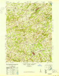
~ Belair MD topo map, 1:62500 scale, 15 X 15 Minute, Historical, 1948
Belair, Maryland, USGS topographic map dated 1948.
Includes geographic coordinates (latitude and longitude). This topographic map is suitable for hiking, camping, and exploring, or framing it as a wall map.
Printed on-demand using high resolution imagery, on heavy weight and acid free paper, or alternatively on a variety of synthetic materials.
Topos available on paper, Waterproof, Poly, or Tyvek. Usually shipping rolled, unless combined with other folded maps in one order.
- Product Number: USGS-5367956
- Free digital map download (high-resolution, GeoPDF): Belair, Maryland (file size: 11 MB)
- Map Size: please refer to the dimensions of the GeoPDF map above
- Weight (paper map): ca. 55 grams
- Map Type: POD USGS Topographic Map
- Map Series: HTMC
- Map Verison: Historical
- Cell ID: 51118
- Scan ID: 257304
- Woodland Tint: Yes
- Aerial Photo Year: 1947
- Field Check Year: 1948
- Datum: NAD27
- Map Projection: Transverse Mercator
- Map published by United States Army Corps of Engineers
- Map published by United States Army
- Map Language: English
- Scanner Resolution: 600 dpi
- Map Cell Name: Belair
- Grid size: 15 X 15 Minute
- Date on map: 1948
- Map Scale: 1:62500
- Geographical region: Maryland, United States
Neighboring Maps:
All neighboring USGS topo maps are available for sale online at a variety of scales.
Spatial coverage:
Topo map Belair, Maryland, covers the geographical area associated the following places:
- Poole - Rockridge Forest - Brierwood - Bramblewood - Glengate - Grose Close - Deer Meadows - Dunsen Heights - Cedarwood - Marywood - Deerfield - Woodridge Manor - Orchard Lakes - Eden Hills - Delano Acres - Green Road Manor - Falls Crest - Benson - Brandywine Farms - Grafton Heights - Fountain Green - Amoss - Cardiff - Shamrock - Powder Mill Addition - Allibone (historical) - Fairmont - Green Ridge - Pheasant Ridge - The Pond - Old Fields - Knollwood - Kiah Estates - Michaels Meadows - Howard Park - Strathmore - Midsummer Hill - Ady Estates - Forest Lake - Village of Thomas Run - Hidden Valley - Tollgate Estates - Putnam - Amyclae Estates - Day Meadows - Fairway - Macton - Jarrettswood - Grafton Shops (historical) - Willows - Fountain Green Estates - Todd Lakes - Calvary - Greenbrier Hills - Putnam View Estates - Stoneleigh - Bynum - Chestnut Hill - Wales of Harford - Furnace - Harford Downs - Brentwood Park - Five Forks - Tudor Forest - Eagle View - Sharon Hill - Federal Hill Heights - Parkwood - Oakmont - Hickory Village Mobile Home Park - Mill Stone Estates - Hampton Ridge - Federal Hill - Locust Knoll - Pegasus Estates - Huntington - Springdale - Highview Estates - Todd Estates - North Harford Heights - Belle Meade - Spring Meadows - Coopstown - Joppa Hills - Pylesville Heights - English Country Manor - Clover Field - Rock Spring - Bel Air - Melrose - Cherby-Maurlyn Estates - West Bangor - Rock Acres - Wildwood - Shawnee - Clear Spring Estates - Carroll Meadows - Winters Run - Cross Country Estates - Vale
- Map Area ID: AREA39.7539.5-76.5-76.25
- Northwest corner Lat/Long code: USGSNW39.75-76.5
- Northeast corner Lat/Long code: USGSNE39.75-76.25
- Southwest corner Lat/Long code: USGSSW39.5-76.5
- Southeast corner Lat/Long code: USGSSE39.5-76.25
- Northern map edge Latitude: 39.75
- Southern map edge Latitude: 39.5
- Western map edge Longitude: -76.5
- Eastern map edge Longitude: -76.25


